Indiana geodata
Indiana (Loreto) is a seat of a third-order administrative division; located in Peru in America/Lima (GMT-5) time zone. In our database, there are 305 cities with bigger population. Compared to other cities in Peru, 99.6% of cities are located further ↓South; 73.5% of cities are located further ←West and 89.6% of cities have higher elevation than Indiana. Note1


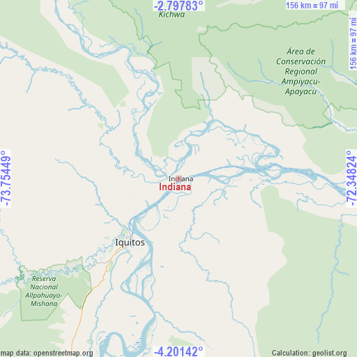
Indiana GPS coordinates[2]
3° 29' 59.604" South, 73° 3' 4.896" West
| Map corner | latitude | longitude |
|---|---|---|
| Upper-left | -2.79783°, | -73.75449° |
| Center: | -3.49989°, | -73.05136° |
| Lower-right: | -4.20142°, | -72.34824° |
| Map W x H: | 156.1×156.1 km | = 97×97mi |
| max Lat: | -0.96667° ⇑0.4% North |
| Indiana: | -3.49989° |
| min Lat: | ⇓99.6% South -18.01465° |
| min Long | Indiana | max Long |
| -81.30472° | -73.05136° | -69.04167° |
| W 73.5%⇐ | ⇒26.5% E |
Elevation
Elevation of Indiana is 94 m = 308 ft, and this is 2224.7 m = 7299 ft below average elevation for this country.
| Max E: |
5022 m = 16476 ft | 89.6% |
| Avg. | 2318.7 m = 7607 ft | |
| Indiana | 94 m = 308 ft | |
Min E: |
1 m = 3 ft | 10.4% |
See also: Peru elevation on elevation.city.
Geographical zone
Indiana is located in South Torrid zone (between Equator and Tropic of Capricorn). Distance of Equator is 389.2 km =241.8 mi to North.| Distance of | km | miles | from Indiana |
|---|---|---|---|
| Equator | 389.2 | 241.8 | to North |
| Tropic Capricorn | 2216.8 | 1377.5 | to South |
| Antarctic Circle | 7012 | 4357.1 | to South |
| South Pole | 9617.9 | 5976.3 | to South |


Nearby cities:
15 places around Indiana: (largest is in red/bold)
• Bretaña
239.3 km =148.7 mi,  214°
214°
• Caballococha
284.9 km =177 mi,  99°
99°
• Concordia
225.8 km =140.3 mi,  238°
238°
• Genaro Herrera
170.8 km =106.1 mi,  203°
203°
• Iberia
269.9 km =167.7 mi, 206°
• Iquitos
35.7 km =22.2 mi,  219°
219°
• Nauta
127.5 km =79.2 mi, 205°
• Parinari
193.8 km =120.4 mi,  232°
232°
• Pebas
134.1 km =83.3 mi,  81°
81°
• Requena
194.9 km =121.1 mi, 207°
• San Antonio del Estrecho
124.2 km =77.2 mi,  19°
19°
• San Juan
71.5 km =44.4 mi, 233°
• Saquena
139.6 km =86.7 mi, 201°
• Tamanco
296.5 km =184.2 mi, 208°
• Trompeteros
225.4 km =140.1 mi,  261°
261°
Sources, notices
• [Note1] Compared only with cities in Peru existing in our database
• [Src1] Map data: © OpenStreetMap contributors (CC-BY-SA)
• [Src2] Other city data from geonames.org with taken over terms of usage.
• [Src3] Geographical zone / Annual Mean Temperature by Robert A. Rohde @ Wikipedia
