Nauta geodata
Nauta (Loreto) is a seat of a third-order administrative division; located in Peru in America/Lima (GMT-5) time zone. In our database, there are 305 cities with bigger population. Compared to other cities in Peru, 97.8% of cities are located further ↓South; 69.8% of cities are located further ←West and 90.2% of cities have higher elevation than Nauta. Note1


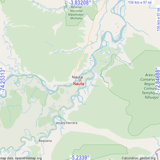
Nauta GPS coordinates[2]
4° 31' 59.988" South, 73° 33' 0" West
| Map corner | latitude | longitude |
|---|---|---|
| Upper-left | -3.83208°, | -74.25313° |
| Center: | -4.53333°, | -73.55° |
| Lower-right: | -5.2339°, | -72.84688° |
| Map W x H: | 155.9×155.9 km | = 96.9×96.9mi |
| max Lat: | -0.96667° ⇑2.2% North |
| Nauta: | -4.53333° |
| min Lat: | ⇓97.8% South -18.01465° |
| min Long | Nauta | max Long |
| -81.30472° | -73.55° | -69.04167° |
| W 69.8%⇐ | ⇒30.2% E |
Elevation
Elevation of Nauta is 91 m = 299 ft, and this is 2227.7 m = 7309 ft below average elevation for this country.
| Max E: |
5022 m = 16476 ft | 90.2% |
| Avg. | 2318.7 m = 7607 ft | |
| Nauta | 91 m = 299 ft | |
Min E: |
1 m = 3 ft | 9.8% |
See also: Peru elevation on elevation.city.
Geographical zone
Nauta is located in South Torrid zone (between Equator and Tropic of Capricorn). Distance of Equator is 504.1 km =313.2 mi to North.| Distance of | km | miles | from Nauta |
|---|---|---|---|
| Equator | 504.1 | 313.2 | to North |
| Tropic Capricorn | 2101.9 | 1306.1 | to South |
| Antarctic Circle | 6897.1 | 4285.7 | to South |
| South Pole | 9503 | 5904.9 | to South |


Nearby cities:
15 places around Nauta: (largest is in red/bold)
• Bretaña
115.1 km =71.5 mi,  224°
224°
• Concordia
136.8 km =85 mi,  268°
268°
• Genaro Herrera
43.6 km =27.1 mi,  197°
197°
• Iberia
142.5 km =88.5 mi,  207°
207°
• Indiana
127.5 km =79.2 mi,  25°
25°
• Iquitos
93.2 km =57.9 mi,  20°
20°
• Parinari
98 km =60.9 mi, 267°
• Pebas
230.8 km =143.4 mi,  54°
54°
• Requena
67.4 km =41.9 mi, 209°
• San Juan
72.1 km =44.8 mi,  358°
358°
• Santa Elena
176.9 km =109.9 mi, 199°
• Santa Isabel
174 km =108.1 mi, 217°
• Saquena
15.3 km =9.5 mi,  166°
166°
• Tamanco
169.2 km =105.1 mi, 210°
• Trompeteros
185.4 km =115.2 mi,  295°
295°
Sources, notices
• [Note1] Compared only with cities in Peru existing in our database
• [Src1] Map data: © OpenStreetMap contributors (CC-BY-SA)
• [Src2] Other city data from geonames.org with taken over terms of usage.
• [Src3] Geographical zone / Annual Mean Temperature by Robert A. Rohde @ Wikipedia
