Iquitos geodata
Iquitos (Loreto) is a seat of a first-order administrative division; located in Peru in America/Lima (GMT-5) time zone. With population of 437,620 people, there are 5 cities with bigger population in this country. Compared to other cities in Peru, 99% of cities are located further ↓South; 71.7% of cities are located further ←West and 90% of cities have higher elevation than Iquitos. Note1


Iquitos GPS coordinates[2]
3° 44' 56.832" South, 73° 15' 13.788" West
| Map corner | latitude | longitude |
|---|---|---|
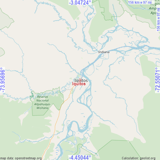
| Upper-left | -3.04724°, | -73.95696° |
| Center: | -3.74912°, | -73.25383° |
| Lower-right: | -4.45044°, | -72.55071° |
| Map W x H: | 156×156 km | = 96.9×96.9mi |
| max Lat: | -0.96667° ⇑1% North |
| Iquitos: | -3.74912° |
| min Lat: | ⇓99% South -18.01465° |
| min Long | Iquitos | max Long |
| -81.30472° | -73.25383° | -69.04167° |
| W 71.7%⇐ | ⇒28.3% E |
Elevation
Elevation of Iquitos is 92 m = 302 ft, and this is 2226.7 m = 7305 ft below average elevation for this country.
| Max E: |
5022 m = 16476 ft | 90% |
| Avg. | 2318.7 m = 7607 ft | |
| Iquitos | 92 m = 302 ft | |
Min E: |
1 m = 3 ft | 10% |
See also: Iquitos elevation on elevation.city.
Geographical zone
Iquitos is located in South Torrid zone (between Equator and Tropic of Capricorn). Distance of Equator is 416.9 km =259 mi to North.| Distance of | km | miles | from Iquitos |
|---|---|---|---|
| Equator | 416.9 | 259 | to North |
| Tropic Capricorn | 2189.1 | 1360.2 | to South |
| Antarctic Circle | 6984.3 | 4339.8 | to South |
| South Pole | 9590.2 | 5959.1 | to South |


Nearby cities:
15 places around Iquitos: (largest is in red/bold)
• Bretaña
203.7 km =126.6 mi,  214°
214°
• Concordia
192.4 km =119.6 mi,  241°
241°
• Genaro Herrera
136.7 km =84.9 mi,  199°
199°
• Iberia
235.2 km =146.1 mi, 204°
• Indiana
35.7 km =22.2 mi,  39°
39°
• Nauta
93.2 km =57.9 mi, 200°
• Parinari
159.3 km =99 mi, 235°
• Pebas
162.1 km =100.7 mi,  73°
73°
• Requena
160.1 km =99.5 mi, 204°
• San Antonio del Estrecho
158.4 km =98.4 mi,  24°
24°
• San Juan
37.9 km =23.5 mi,  246°
246°
• Santa Isabel
264.4 km =164.3 mi, 211°
• Saquena
106.1 km =65.9 mi, 195°
• Tamanco
261.6 km =162.6 mi, 206°
• Trompeteros
200.3 km =124.5 mi,  267°
267°
Sources, notices
• [Note1] Compared only with cities in Peru existing in our database
• [Src1] Map data: © OpenStreetMap contributors (CC-BY-SA)
• [Src2] Other city data from geonames.org with taken over terms of usage.
• [Src3] Geographical zone / Annual Mean Temperature by Robert A. Rohde @ Wikipedia
