San Lorenzo geodata
San Lorenzo (Loreto) is a seat of a third-order administrative division; located in Peru in America/Lima (GMT-5) time zone. In our database, there are 305 cities with bigger population. Compared to other cities in Peru, 96.7% of cities are located further ↓South; 60.4% of cities are located further →East and 87.2% of cities have higher elevation than San Lorenzo. Note1


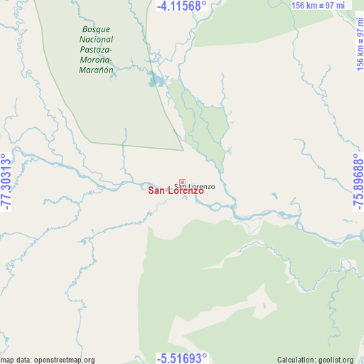
San Lorenzo GPS coordinates[2]
4° 49' 0.012" South, 76° 36' 0" West
| Map corner | latitude | longitude |
|---|---|---|
| Upper-left | -4.11568°, | -77.30313° |
| Center: | -4.81667°, | -76.6° |
| Lower-right: | -5.51693°, | -75.89688° |
| Map W x H: | 155.8×155.8 km | = 96.8×96.8mi |
| max Lat: | -0.96667° ⇑3.3% North |
| San Lorenzo: | -4.81667° |
| min Lat: | ⇓96.7% South -18.01465° |
| min Long | San Lorenzo | max Long |
| -81.30472° | -76.6° | -69.04167° |
| W 39.6%⇐ | ⇒60.4% E |
Elevation
Elevation of San Lorenzo is 146 m = 479 ft, and this is 2172.7 m = 7128 ft below average elevation for this country.
| Max E: |
5022 m = 16476 ft | 87.2% |
| Avg. | 2318.7 m = 7607 ft | |
| San Lorenzo | 146 m = 479 ft | |
Min E: |
1 m = 3 ft | 12.8% |
See also: Peru elevation on elevation.city.
Geographical zone
San Lorenzo is located in South Torrid zone (between Equator and Tropic of Capricorn). Distance of Equator is 535.6 km =332.8 mi to North.| Distance of | km | miles | from San Lorenzo |
|---|---|---|---|
| Equator | 535.6 | 332.8 | to North |
| Tropic Capricorn | 2070.4 | 1286.5 | to South |
| Antarctic Circle | 6865.6 | 4266.1 | to South |
| South Pole | 9471.5 | 5885.3 | to South |


Nearby cities:
15 places around San Lorenzo: (largest is in red/bold)
• Alianza Cristiana
150.3 km =93.4 mi,  7°
7°
• Bajo Naranjillo
140.9 km =87.6 mi,  217°
217°
• Barranca
8.6 km =5.3 mi,  257°
257°
• Calzada
144.7 km =89.9 mi,  200°
200°
• Jeberos
62.6 km =38.9 mi,  145°
145°
• Jepelacio
149.6 km =93 mi, 195°
• Lagunas
112.1 km =69.7 mi,  114°
114°
• Moyobamba
141.5 km =87.9 mi, 196°
• Naranjos
143.1 km =88.9 mi, 223°
• Nueva Cajamarca
147.5 km =91.7 mi,  212°
212°
• Posic
147 km =91.3 mi, 205°
• Santa Cruz
120.4 km =74.8 mi,  132°
132°
• Saramiriza
94.6 km =58.8 mi,  287°
287°
• Yuracyacu
142 km =88.2 mi, 209°
• Yurimaguas
131.7 km =81.8 mi,  156°
156°
Sources, notices
• [Note1] Compared only with cities in Peru existing in our database
• [Src1] Map data: © OpenStreetMap contributors (CC-BY-SA)
• [Src2] Other city data from geonames.org with taken over terms of usage.
• [Src3] Geographical zone / Annual Mean Temperature by Robert A. Rohde @ Wikipedia
