Jeberos geodata
Jeberos (Loreto) is a seat of a third-order administrative division; located in Peru in America/Lima (GMT-5) time zone. In our database, there are 305 cities with bigger population. Compared to other cities in Peru, 94% of cities are located further ↓South; 56.4% of cities are located further →East and 86.8% of cities have higher elevation than Jeberos. Note1


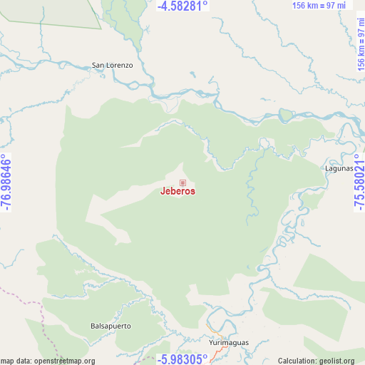
Jeberos GPS coordinates[2]
5° 16' 59.988" South, 76° 16' 59.988" West
| Map corner | latitude | longitude |
|---|---|---|
| Upper-left | -4.58281°, | -76.98646° |
| Center: | -5.28333°, | -76.28333° |
| Lower-right: | -5.98305°, | -75.58021° |
| Map W x H: | 155.7×155.7 km | = 96.7×96.7mi |
| max Lat: | -0.96667° ⇑6% North |
| Jeberos: | -5.28333° |
| min Lat: | ⇓94% South -18.01465° |
| min Long | Jeberos | max Long |
| -81.30472° | -76.28333° | -69.04167° |
| W 43.6%⇐ | ⇒56.4% E |
Elevation
Elevation of Jeberos is 148 m = 486 ft, and this is 2170.7 m = 7122 ft below average elevation for this country.
| Max E: |
5022 m = 16476 ft | 86.8% |
| Avg. | 2318.7 m = 7607 ft | |
| Jeberos | 148 m = 486 ft | |
Min E: |
1 m = 3 ft | 13.2% |
See also: Peru elevation on elevation.city.
Geographical zone
Jeberos is located in South Torrid zone (between Equator and Tropic of Capricorn). Distance of Equator is 587.5 km =365.1 mi to North.| Distance of | km | miles | from Jeberos |
|---|---|---|---|
| Equator | 587.5 | 365.1 | to North |
| Tropic Capricorn | 2018.5 | 1254.2 | to South |
| Antarctic Circle | 6813.7 | 4233.8 | to South |
| South Pole | 9419.6 | 5853.1 | to South |


Nearby cities:
15 places around Jeberos: (largest is in red/bold)
• Barranca
66.3 km =41.2 mi,  319°
319°
• Barranquita
113.2 km =70.3 mi,  164°
164°
• Calzada
120.1 km =74.6 mi,  226°
226°
• Habana
125.9 km =78.2 mi, 225°
• Jepelacio
118.4 km =73.6 mi,  218°
218°
• Lagunas
67.6 km =42 mi,  84°
84°
• Moyobamba
113 km =70.2 mi, 222°
• Pelejo
115.9 km =72 mi,  153°
153°
• Posic
126.8 km =78.8 mi, 230°
• San Antonio
120.7 km =75 mi,  183°
183°
• San Lorenzo
62.6 km =38.9 mi,  325°
325°
• Santa Cruz
61.2 km =38 mi,  118°
118°
• Shucushuyacu
94.6 km =58.8 mi, 149°
• Tabalosos
126.6 km =78.7 mi,  200°
200°
• Yurimaguas
71 km =44.1 mi,  165°
165°
Sources, notices
• [Note1] Compared only with cities in Peru existing in our database
• [Src1] Map data: © OpenStreetMap contributors (CC-BY-SA)
• [Src2] Other city data from geonames.org with taken over terms of usage.
• [Src3] Geographical zone / Annual Mean Temperature by Robert A. Rohde @ Wikipedia
