Barranca geodata
Barranca (Loreto) is a populated place; located in Peru in America/Lima (GMT-5) time zone. With population of 5,779 people, there are 215 cities with bigger population in this country. Compared to other cities in Peru, 96.7% of cities are located further ↓South; 61.8% of cities are located further →East and 85.7% of cities have higher elevation than Barranca. Note1


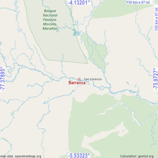
Barranca GPS coordinates[2]
4° 49' 58.728" South, 76° 40' 32.952" West
| Map corner | latitude | longitude |
|---|---|---|
| Upper-left | -4.13201°, | -77.37895° |
| Center: | -4.83298°, | -76.67582° |
| Lower-right: | -5.53323°, | -75.9727° |
| Map W x H: | 155.8×155.8 km | = 96.8×96.8mi |
| max Lat: | -0.96667° ⇑3.3% North |
| Barranca: | -4.83298° |
| min Lat: | ⇓96.7% South -18.01465° |
| min Long | Barranca | max Long |
| -81.30472° | -76.67582° | -69.04167° |
| W 38.2%⇐ | ⇒61.8% E |
Elevation
Elevation of Barranca is 165 m = 541 ft, and this is 2153.7 m = 7066 ft below average elevation for this country.
| Max E: |
5022 m = 16476 ft | 85.7% |
| Avg. | 2318.7 m = 7607 ft | |
| Barranca | 165 m = 541 ft | |
Min E: |
1 m = 3 ft | 14.3% |
See also: Peru elevation on elevation.city.
Geographical zone
Barranca is located in South Torrid zone (between Equator and Tropic of Capricorn). Distance of Equator is 537.4 km =333.9 mi to North.| Distance of | km | miles | from Barranca |
|---|---|---|---|
| Equator | 537.4 | 333.9 | to North |
| Tropic Capricorn | 2068.5 | 1285.3 | to South |
| Antarctic Circle | 6863.8 | 4265 | to South |
| South Pole | 9469.7 | 5884.2 | to South |


Nearby cities:
15 places around Barranca: (largest is in red/bold)
• Bajo Naranjillo
134.4 km =83.5 mi,  215°
215°
• Calzada
140.1 km =87.1 mi,  197°
197°
• Habana
146.2 km =90.8 mi, 198°
• Jeberos
66.3 km =41.2 mi,  139°
139°
• Jepelacio
145.9 km =90.7 mi,  192°
192°
• Lagunas
119.2 km =74.1 mi,  111°
111°
• Moyobamba
137.5 km =85.4 mi, 193°
• Naranjos
136 km =84.5 mi, 221°
• Nueva Cajamarca
141.6 km =88 mi,  209°
209°
• Posic
142 km =88.2 mi, 202°
• San Lorenzo
8.6 km =5.3 mi,  77°
77°
• Santa Cruz
125.5 km =78 mi,  129°
129°
• Saramiriza
87.2 km =54.2 mi,  289°
289°
• Yuracyacu
136.5 km =84.8 mi, 206°
• Yurimaguas
133.7 km =83.1 mi,  152°
152°
Sources, notices
• [Note1] Compared only with cities in Peru existing in our database
• [Src1] Map data: © OpenStreetMap contributors (CC-BY-SA)
• [Src2] Other city data from geonames.org with taken over terms of usage.
• [Src3] Geographical zone / Annual Mean Temperature by Robert A. Rohde @ Wikipedia
