Papayal geodata
Papayal (Tumbes) is a populated place; located in Peru in America/Lima (GMT-5) time zone. With population of 5,484 people, there are 225 cities with bigger population in this country. Compared to other cities in Peru, 98.5% of cities are located further ↓South; 98.4% of cities are located further →East and 82% of cities have higher elevation than Papayal. Note1
Administrative division(s):
- Level 1: Tumbes
- Level 2: Provincia de Contralmirante Villar
- Level 3: Casitas


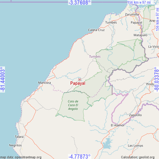
Papayal GPS coordinates[2]
4° 4' 39.756" South, 80° 44' 12.84" West
| Map corner | latitude | longitude |
|---|---|---|
| Upper-left | -3.37608°, | -81.44003° |
| Center: | -4.07771°, | -80.7369° |
| Lower-right: | -4.77873°, | -80.03378° |
| Map W x H: | 156×156 km | = 96.9×96.9mi |
| max Lat: | -0.96667° ⇑1.5% North |
| Papayal: | -4.07771° |
| min Lat: | ⇓98.5% South -18.01465° |
| min Long | Papayal | max Long |
| -81.30472° | -80.7369° | -69.04167° |
| W 1.6%⇐ | ⇒98.4% E |
Elevation
Elevation of Papayal is 262 m = 860 ft, and this is 2056.7 m = 6748 ft below average elevation for this country.
| Max E: |
5022 m = 16476 ft | 82% |
| Avg. | 2318.7 m = 7607 ft | |
| Papayal | 262 m = 860 ft | |
Min E: |
1 m = 3 ft | 18% |
See also: Peru elevation on elevation.city.
Geographical zone
Papayal is located in South Torrid zone (between Equator and Tropic of Capricorn). Distance of Equator is 453.4 km =281.7 mi to North.| Distance of | km | miles | from Papayal |
|---|---|---|---|
| Equator | 453.4 | 281.7 | to North |
| Tropic Capricorn | 2152.5 | 1337.5 | to South |
| Antarctic Circle | 6947.8 | 4317.2 | to South |
| South Pole | 9553.7 | 5936.4 | to South |


Nearby cities:
15 places around Papayal: (largest is in red/bold)
• Caleta Cruz
51.5 km =32 mi,  18°
18°
• Cancas
27 km =16.8 mi,  302°
302°
• Cañaveral
17.9 km =11.1 mi,  32°
32°
• El Alto
57.3 km =35.6 mi,  248°
248°
• La Breita
25.9 km =16.1 mi,  219°
219°
• Lobitos
73.9 km =45.9 mi,  235°
235°
• Los Organos
44.4 km =27.6 mi,  255°
255°
• Matapalo
74.1 km =46 mi,  53°
53°
• Máncora
34.6 km =21.5 mi, 264°
• Papayal
79.3 km =49.3 mi, 47°
• San Jacinto
58.1 km =36.1 mi, 33°
• Talara
81.3 km =50.5 mi,  226°
226°
• Tumbes
65 km =40.4 mi, 29°
• Zarumilla
82 km =51 mi,  38°
38°
• Zorritos
44.6 km =27.7 mi,  8°
8°
Sources, notices
• [Note1] Compared only with cities in Peru existing in our database
• [Src1] Map data: © OpenStreetMap contributors (CC-BY-SA)
• [Src2] Other city data from geonames.org with taken over terms of usage.
• [Src3] Geographical zone / Annual Mean Temperature by Robert A. Rohde @ Wikipedia
