Tingo María geodata
Tingo María (Huanuco) is a populated place; located in Peru in America/Lima (GMT-5) time zone. With population of 53,177 people, there are 36 cities with bigger population in this country. Compared to other cities in Peru, 66.3% of cities are located further ↓South; 52.9% of cities are located further →East and 75.9% of cities have higher elevation than Tingo María. Note1


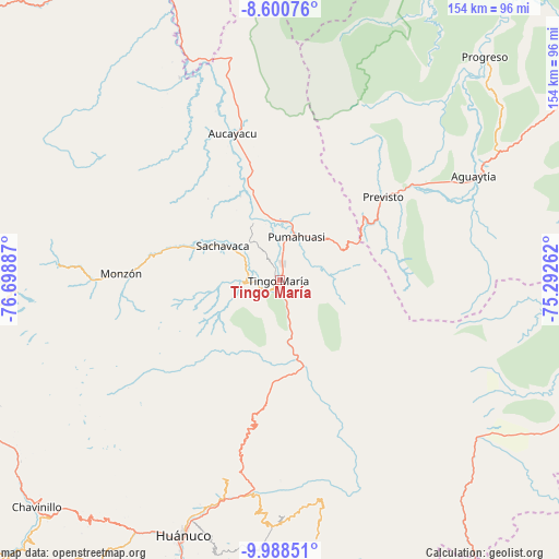
Tingo María GPS coordinates[2]
9° 17' 43.152" South, 75° 59' 44.664" West
| Map corner | latitude | longitude |
|---|---|---|
| Upper-left | -8.60076°, | -76.69887° |
| Center: | -9.29532°, | -75.99574° |
| Lower-right: | -9.98851°, | -75.29262° |
| Map W x H: | 154.3×154.3 km | = 95.9×95.9mi |
| max Lat: | -0.96667° ⇑33.7% North |
| Tingo María: | -9.29532° |
| min Lat: | ⇓66.3% South -18.01465° |
| min Long | Tingo María | max Long |
| -81.30472° | -75.99574° | -69.04167° |
| W 47.1%⇐ | ⇒52.9% E |
Elevation
Elevation of Tingo María is 647 m = 2123 ft, and this is 1671.7 m = 5485 ft below average elevation for this country.
| Max E: |
5022 m = 16476 ft | 75.9% |
| Avg. | 2318.7 m = 7607 ft | |
| Tingo María | 647 m = 2123 ft | |
Min E: |
1 m = 3 ft | 24.1% |
See also: Tingo María elevation on elevation.city.
Geographical zone
Tingo María is located in South Torrid zone (between Equator and Tropic of Capricorn). Distance of Equator is 1033.5 km =642.2 mi to North.| Distance of | km | miles | from Tingo María |
|---|---|---|---|
| Equator | 1033.5 | 642.2 | to North |
| Tropic Capricorn | 1572.4 | 977 | to South |
| Antarctic Circle | 6367.6 | 3956.6 | to South |
| South Pole | 8973.5 | 5575.9 | to South |


Nearby cities:
15 places around Tingo María: (largest is in red/bold)
• Acomayo
56.8 km =35.3 mi,  188°
188°
• Arancay
83.8 km =52.1 mi,  279°
279°
• Aucayacu
42.5 km =26.4 mi,  342°
342°
• Cayhuayna
78.8 km =49 mi,  200°
200°
• Chaglla
61.8 km =38.4 mi,  170°
170°
• Churubamba
60.9 km =37.8 mi, 194°
• Conchamarca
86 km =53.4 mi, 196°
• Huancapallac
80.9 km =50.3 mi,  214°
214°
• Huánuco
75.6 km =47 mi, 200°
• Jacas Grande
85.7 km =53.3 mi,  251°
251°
• Las Palmas
9.9 km =6.2 mi, 185°
• Panao
67 km =41.6 mi,  179°
179°
• Paucarbamba
76.4 km =47.5 mi, 199°
• Rapayan
84.5 km =52.5 mi, 277°
• Tantamayo
80.5 km =50 mi,  262°
262°
Sources, notices
• [Note1] Compared only with cities in Peru existing in our database
• [Src1] Map data: © OpenStreetMap contributors (CC-BY-SA)
• [Src2] Other city data from geonames.org with taken over terms of usage.
• [Src3] Geographical zone / Annual Mean Temperature by Robert A. Rohde @ Wikipedia
