Tugos geodata
Tugos (Bicol) is a populated place; located in Philippines in Asia/Manila (GMT+8) time zone. With population of 3,818 people, there are 1831 cities with bigger population in this country. Compared to other cities in Philippines, 72.5% of cities are located further ↓South; 50.8% of cities are located further →East and 67.1% of cities have lower elevation than Tugos. Note1


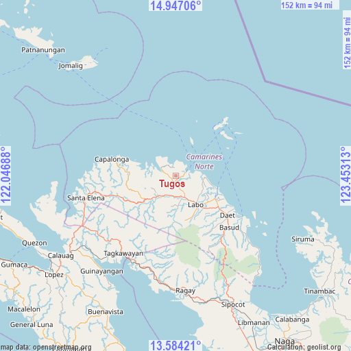
Tugos GPS coordinates[2]
14° 16' 0.012" North, 122° 45' 0" East
| Map corner | latitude | longitude |
|---|---|---|
| Upper-left | 14.94706°, | 122.04688° |
| Center: | 14.26667°, | 122.75° |
| Lower-right: | 13.58421°, | 123.45313° |
| Map W x H: | 151.5×151.5 km | = 94.1×94.1mi |
| max Lat: | 20.78733° ⇑27.5% North |
| Tugos: | 14.26667° |
| min Lat: | ⇓72.5% South 4.65442° |
| min Long | Tugos | max Long |
| 117.04868° | 122.75° | 126.58417° |
| W 49.2%⇐ | ⇒50.8% E |
Elevation
Elevation of Tugos is 46 m = 151 ft, and this is 41.9 m = 137 ft below average elevation for this country.
| Max E: |
2262 m = 7421 ft | 32.9% |
| Avg. | 87.9 m = 288 ft | |
| Tugos | 46 m = 151 ft | |
Min E: |
-2 m = -7 ft | 67.1% |
See also: Philippines elevation on elevation.city.
Geographical zone
Tugos is located in North Torrid zone (between Equator and Tropic of Cancer). Distance of this Northern Tropic circle is 1019.6 km =633.5 mi to North.| Distance of | km | miles | from Tugos |
|---|---|---|---|
| North Pole | 8420.8 | 5232.4 | to North |
| Arctic Circle | 5814.9 | 3613.2 | to North |
| Tropic Cancer | 1019.6 | 633.5 | to North |
| Equator | 1586.3 | 985.7 | to South |


Nearby cities:
15 places around Tugos: (largest is in red/bold)
• Banocboc
18.3 km =11.4 mi,  281°
281°
• Batobalane
3.7 km =2.3 mi,  180°
180°
• Daguit
8.9 km =5.5 mi,  196°
196°
• Guinacotan
17.6 km =10.9 mi,  133°
133°
• Gumaus
5.7 km =3.5 mi,  328°
328°
• Jose Pañganiban
6.8 km =4.2 mi,  292°
292°
• Labo
15.3 km =9.5 mi,  145°
145°
• Larap
11.3 km =7 mi, 288°
• Lugui
17.7 km =11 mi,  164°
164°
• Luklukan
7.7 km =4.8 mi, 328°
• Malasugui
17.2 km =10.7 mi,  142°
142°
• Paracale
4.4 km =2.7 mi,  69°
69°
• Sabang Indan
18.6 km =11.6 mi,  106°
106°
• Santa Rosa Sur
3 km =1.9 mi,  253°
253°
• Talubatib
10.1 km =6.3 mi, 157°
Sources, notices
• [Note1] Compared only with cities in Philippines existing in our database
• [Src1] Map data: © OpenStreetMap contributors (CC-BY-SA)
• [Src2] Other city data from geonames.org with taken over terms of usage.
• [Src3] Geographical zone / Annual Mean Temperature by Robert A. Rohde @ Wikipedia
