Banocboc geodata
Banocboc (Bicol) is a populated place; located in Philippines in Asia/Manila (GMT+8) time zone. With population of 3,963 people, there are 1753 cities with bigger population in this country. Compared to other cities in Philippines, 72.9% of cities are located further ↓South; 53.2% of cities are located further →East and 86.4% of cities have lower elevation than Banocboc. Note1
Administrative division(s):
- Level 1: Bicol
- Level 2: Province of Camarines Norte
- Level 3: Jose Panganiban


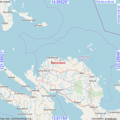
Banocboc GPS coordinates[2]
14° 18' 0" North, 122° 34' 59.988" East
| Map corner | latitude | longitude |
|---|---|---|
| Upper-left | 14.98029°, | 121.88021° |
| Center: | 14.3°, | 122.58333° |
| Lower-right: | 13.61764°, | 123.28646° |
| Map W x H: | 151.5×151.5 km | = 94.1×94.1mi |
| max Lat: | 20.78733° ⇑27.1% North |
| Banocboc: | 14.3° |
| min Lat: | ⇓72.9% South 4.65442° |
| min Long | Banocboc | max Long |
| 117.04868° | 122.58333° | 126.58417° |
| W 46.8%⇐ | ⇒53.2% E |
Elevation
Elevation of Banocboc is 157 m = 515 ft, and this is 69.1 m = 227 ft above average elevation for this country.
| Max E: |
2262 m = 7421 ft | 13.6% |
| Banocboc | 157 m 515 ft | |
| Avg. | 87.9 m = 288 ft | |
Min E: |
-2 m = -7 ft | 86.4% |
See also: Philippines elevation on elevation.city.
Geographical zone
Banocboc is located in North Torrid zone (between Equator and Tropic of Cancer). Distance of this Northern Tropic circle is 1015.9 km =631.3 mi to North.| Distance of | km | miles | from Banocboc |
|---|---|---|---|
| North Pole | 8417.1 | 5230.1 | to North |
| Arctic Circle | 5811.2 | 3610.9 | to North |
| Tropic Cancer | 1015.9 | 631.3 | to North |
| Equator | 1590 | 988 | to South |


Nearby cities:
15 places around Banocboc: (largest is in red/bold)
• Alayao
3.9 km =2.4 mi,  238°
238°
• Batobalane
19.4 km =12.1 mi,  112°
112°
• Calabaca
16.1 km =10 mi,  270°
270°
• Capalonga
10.2 km =6.3 mi,  289°
289°
• Daguit
19.7 km =12.2 mi,  128°
128°
• Gumaus
15.1 km =9.4 mi,  85°
85°
• Jose Pañganiban
11.7 km =7.3 mi,  95°
95°
• Larap
7.2 km =4.5 mi, 90°
• Luklukan
14.2 km =8.8 mi,  78°
78°
• Malatap
14.7 km =9.1 mi,  211°
211°
• Palali
10.5 km =6.5 mi, 273°
• Paracale
22.2 km =13.8 mi, 95°
• Santa Rosa Sur
15.8 km =9.8 mi, 106°
• Tigbinan
17.6 km =10.9 mi,  224°
224°
• Tugos
18.3 km =11.4 mi, 101°
Sources, notices
• [Note1] Compared only with cities in Philippines existing in our database
• [Src1] Map data: © OpenStreetMap contributors (CC-BY-SA)
• [Src2] Other city data from geonames.org with taken over terms of usage.
• [Src3] Geographical zone / Annual Mean Temperature by Robert A. Rohde @ Wikipedia
