Gumaus geodata
Gumaus (Bicol) is a populated place; located in Philippines in Asia/Manila (GMT+8) time zone. With population of 2,346 people, there are 3569 cities with bigger population in this country. Compared to other cities in Philippines, 73% of cities are located further ↓South; 51.1% of cities are located further →East and 92.7% of cities have higher elevation than Gumaus. Note1
Administrative division(s):
- Level 1: Bicol
- Level 2: Province of Camarines Norte
- Level 3: Jose Panganiban


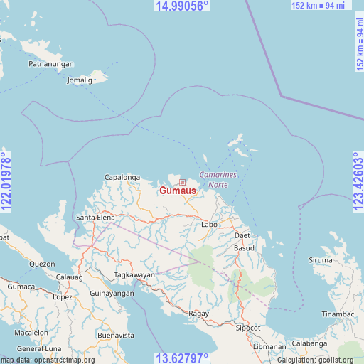
Gumaus GPS coordinates[2]
14° 18' 37.08" North, 122° 43' 22.44" East
| Map corner | latitude | longitude |
|---|---|---|
| Upper-left | 14.99056°, | 122.01978° |
| Center: | 14.3103°, | 122.7229° |
| Lower-right: | 13.62797°, | 123.42603° |
| Map W x H: | 151.5×151.5 km | = 94.1×94.1mi |
| max Lat: | 20.78733° ⇑27% North |
| Gumaus: | 14.3103° |
| min Lat: | ⇓73% South 4.65442° |
| min Long | Gumaus | max Long |
| 117.04868° | 122.7229° | 126.58417° |
| W 48.9%⇐ | ⇒51.1% E |
Elevation
Elevation of Gumaus is 6 m = 20 ft, and this is 81.9 m = 269 ft below average elevation for this country.
| Max E: |
2262 m = 7421 ft | 92.7% |
| Avg. | 87.9 m = 288 ft | |
| Gumaus | 6 m = 20 ft | |
Min E: |
-2 m = -7 ft | 7.3% |
See also: Philippines elevation on elevation.city.
Geographical zone
Gumaus is located in North Torrid zone (between Equator and Tropic of Cancer). Distance of this Northern Tropic circle is 1014.8 km =630.6 mi to North.| Distance of | km | miles | from Gumaus |
|---|---|---|---|
| North Pole | 8415.9 | 5229.4 | to North |
| Arctic Circle | 5810 | 3610.2 | to North |
| Tropic Cancer | 1014.8 | 630.6 | to North |
| Equator | 1591.2 | 988.7 | to South |


Nearby cities:
15 places around Gumaus: (largest is in red/bold)
• Alayao
18.6 km =11.6 mi,  260°
260°
• Banocboc
15.1 km =9.4 mi,  265°
265°
• Batobalane
9 km =5.6 mi,  161°
161°
• Daguit
13.4 km =8.3 mi,  178°
178°
• Guinacotan
23.1 km =14.4 mi,  137°
137°
• Jose Pañganiban
4 km =2.5 mi,  236°
236°
• Labo
21 km =13 mi,  146°
146°
• Larap
7.9 km =4.9 mi, 260°
• Luklukan
2 km =1.2 mi,  326°
326°
• Malasugui
22.8 km =14.2 mi, 144°
• Paracale
7.8 km =4.8 mi,  115°
115°
• Sabang Indan
23 km =14.3 mi, 116°
• Santa Rosa Sur
5.7 km =3.5 mi, 179°
• Talubatib
15.7 km =9.8 mi, 154°
• Tugos
5.7 km =3.5 mi, 148°
Sources, notices
• [Note1] Compared only with cities in Philippines existing in our database
• [Src1] Map data: © OpenStreetMap contributors (CC-BY-SA)
• [Src2] Other city data from geonames.org with taken over terms of usage.
• [Src3] Geographical zone / Annual Mean Temperature by Robert A. Rohde @ Wikipedia
