Santa Rosa Sur geodata
Santa Rosa Sur (Bicol) is a populated place; located in Philippines in Asia/Manila (GMT+8) time zone. With population of 2,295 people, there are 3694 cities with bigger population in this country. Compared to other cities in Philippines, 72.4% of cities are located further ↓South; 51.1% of cities are located further →East and 62.2% of cities have lower elevation than Santa Rosa Sur. Note1
Administrative division(s):
- Level 1: Bicol
- Level 2: Province of Camarines Norte
- Level 3: Jose Panganiban


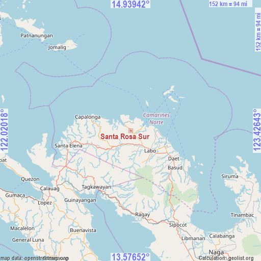
Santa Rosa Sur GPS coordinates[2]
14° 15' 32.4" North, 122° 43' 23.88" East
| Map corner | latitude | longitude |
|---|---|---|
| Upper-left | 14.93942°, | 122.02018° |
| Center: | 14.259°, | 122.7233° |
| Lower-right: | 13.57652°, | 123.42643° |
| Map W x H: | 151.5×151.5 km | = 94.1×94.1mi |
| max Lat: | 20.78733° ⇑27.6% North |
| Santa Rosa Sur: | 14.259° |
| min Lat: | ⇓72.4% South 4.65442° |
| min Long | Santa Rosa Sur | max Long |
| 117.04868° | 122.7233° | 126.58417° |
| W 48.9%⇐ | ⇒51.1% E |
Elevation
Elevation of Santa Rosa Sur is 37 m = 121 ft, and this is 50.9 m = 167 ft below average elevation for this country.
| Max E: |
2262 m = 7421 ft | 37.8% |
| Avg. | 87.9 m = 288 ft | |
| Santa Rosa Sur | 37 m = 121 ft | |
Min E: |
-2 m = -7 ft | 62.2% |
See also: Philippines elevation on elevation.city.
Geographical zone
Santa Rosa Sur is located in North Torrid zone (between Equator and Tropic of Cancer). Distance of this Northern Tropic circle is 1020.5 km =634.1 mi to North.| Distance of | km | miles | from Santa Rosa Sur |
|---|---|---|---|
| North Pole | 8421.6 | 5232.9 | to North |
| Arctic Circle | 5815.7 | 3613.7 | to North |
| Tropic Cancer | 1020.5 | 634.1 | to North |
| Equator | 1585.5 | 985.2 | to South |


Nearby cities:
15 places around Santa Rosa Sur: (largest is in red/bold)
• Alayao
18.6 km =11.6 mi,  277°
277°
• Banocboc
15.8 km =9.8 mi,  286°
286°
• Batobalane
4.1 km =2.5 mi,  134°
134°
• Daguit
7.7 km =4.8 mi,  177°
177°
• Guinacotan
19.3 km =12 mi, 126°
• Gumaus
5.7 km =3.5 mi,  359°
359°
• Jose Pañganiban
4.9 km =3 mi,  315°
315°
• Labo
16.5 km =10.3 mi,  135°
135°
• Larap
9 km =5.6 mi,  299°
299°
• Lugui
17.9 km =11.1 mi,  154°
154°
• Luklukan
7.5 km =4.7 mi,  350°
350°
• Malasugui
18.5 km =11.5 mi, 133°
• Paracale
7.4 km =4.6 mi,  71°
71°
• Talubatib
10.8 km =6.7 mi, 141°
• Tugos
3 km =1.9 mi, 73°
Sources, notices
• [Note1] Compared only with cities in Philippines existing in our database
• [Src1] Map data: © OpenStreetMap contributors (CC-BY-SA)
• [Src2] Other city data from geonames.org with taken over terms of usage.
• [Src3] Geographical zone / Annual Mean Temperature by Robert A. Rohde @ Wikipedia
