Tibigan geodata
Tibigan (Central Visayas) is a populated place; located in Philippines in Asia/Manila (GMT+8) time zone. With population of 11,262 people, there are 545 cities with bigger population in this country. Compared to other cities in Philippines, 68.7% of cities are located further ↑North; 70.2% of cities are located further ←West and 98.1% of cities have higher elevation than Tibigan. Note1


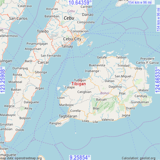
Tibigan GPS coordinates[2]
9° 57' 6.48" North, 123° 57' 43.92" East
| Map corner | latitude | longitude |
|---|---|---|
| Upper-left | 10.64359°, | 123.25908° |
| Center: | 9.9518°, | 123.9622° |
| Lower-right: | 9.25854°, | 124.66533° |
| Map W x H: | 154×154 km | = 95.7×95.7mi |
| max Lat: | 20.78733° ⇑68.7% North |
| Tibigan: | 9.9518° |
| min Lat: | ⇓31.3% South 4.65442° |
| min Long | Tibigan | max Long |
| 117.04868° | 123.9622° | 126.58417° |
| W 70.2%⇐ | ⇒29.8% E |
Elevation
Elevation of Tibigan is 3 m = 10 ft, and this is 84.9 m = 279 ft below average elevation for this country.
| Max E: |
2262 m = 7421 ft | 98.1% |
| Avg. | 87.9 m = 288 ft | |
| Tibigan | 3 m = 10 ft | |
Min E: |
-2 m = -7 ft | 1.9% |
See also: Philippines elevation on elevation.city.
Geographical zone
Tibigan is located in North Torrid zone (between Equator and Tropic of Cancer). Distance of Equator is 1106.5 km =687.5 mi to South.| Distance of | km | miles | from Tibigan |
|---|---|---|---|
| North Pole | 8900.5 | 5530.5 | to North |
| Arctic Circle | 6294.6 | 3911.3 | to North |
| Tropic Cancer | 1499.4 | 931.7 | to North |
| Equator | 1106.5 | 687.5 | to South |


Nearby cities:
15 places around Tibigan: (largest is in red/bold)
• Abucayan
5.8 km =3.6 mi,  244°
244°
• Antequera
20.2 km =12.6 mi,  200°
200°
• Bagacay
10.7 km =6.6 mi,  207°
207°
• Balilihan
21.8 km =13.5 mi,  176°
176°
• Buenavista
22.3 km =13.9 mi,  49°
49°
• Calape
11.6 km =7.2 mi, 235°
• Canmaya Diot
14.5 km =9 mi,  95°
95°
• Catigbian
12 km =7.5 mi,  160°
160°
• Clarin
7 km =4.3 mi,  81°
81°
• Inabanga
14.5 km =9 mi, 52°
• Nahawan
9.7 km =6 mi, 77°
• Panaytayon
2.3 km =1.4 mi,  94°
94°
• Pinayagan Norte
2.5 km =1.6 mi, 213°
• Sagbayan
14.8 km =9.2 mi,  106°
106°
• San Isidro
9.5 km =5.9 mi,  245°
245°
Sources, notices
• [Note1] Compared only with cities in Philippines existing in our database
• [Src1] Map data: © OpenStreetMap contributors (CC-BY-SA)
• [Src2] Other city data from geonames.org with taken over terms of usage.
• [Src3] Geographical zone / Annual Mean Temperature by Robert A. Rohde @ Wikipedia
