Balilihan geodata
Balilihan (Central Visayas) is a seat of a third-order administrative division; located in Philippines in Asia/Manila (GMT+8) time zone. With population of 2,931 people, there are 2609 cities with bigger population in this country. Compared to other cities in Philippines, 71% of cities are located further ↑North; 70.4% of cities are located further ←West and 81.7% of cities have lower elevation than Balilihan. Note1


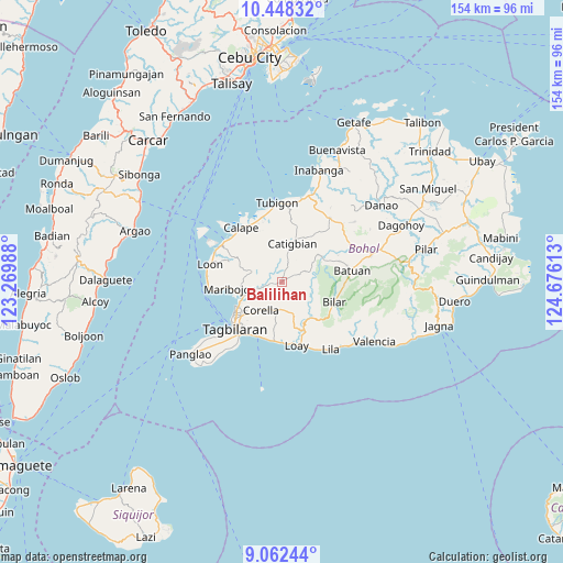
Balilihan GPS coordinates[2]
9° 45' 21.96" North, 123° 58' 22.8" East
| Map corner | latitude | longitude |
|---|---|---|
| Upper-left | 10.44832°, | 123.26988° |
| Center: | 9.7561°, | 123.973° |
| Lower-right: | 9.06244°, | 124.67613° |
| Map W x H: | 154.1×154.1 km | = 95.8×95.8mi |
| max Lat: | 20.78733° ⇑71% North |
| Balilihan: | 9.7561° |
| min Lat: | ⇓29% South 4.65442° |
| min Long | Balilihan | max Long |
| 117.04868° | 123.973° | 126.58417° |
| W 70.4%⇐ | ⇒29.6% E |
Elevation
Elevation of Balilihan is 104 m = 341 ft, and this is 16.1 m = 53 ft above average elevation for this country.
| Max E: |
2262 m = 7421 ft | 18.3% |
| Balilihan | 104 m 341 ft | |
| Avg. | 87.9 m = 288 ft | |
Min E: |
-2 m = -7 ft | 81.7% |
See also: Philippines elevation on elevation.city.
Geographical zone
Balilihan is located in North Torrid zone (between Equator and Tropic of Cancer). Distance of Equator is 1084.8 km =674.1 mi to South.| Distance of | km | miles | from Balilihan |
|---|---|---|---|
| North Pole | 8922.3 | 5544.1 | to North |
| Arctic Circle | 6316.4 | 3924.8 | to North |
| Tropic Cancer | 1521.1 | 945.2 | to North |
| Equator | 1084.8 | 674.1 | to South |


Nearby cities:
15 places around Balilihan: (largest is in red/bold)
• Alburquerque
16.5 km =10.3 mi,  185°
185°
• Antequera
8.6 km =5.3 mi,  288°
288°
• Baclayon
16.8 km =10.4 mi,  210°
210°
• Bagacay
13.7 km =8.5 mi,  333°
333°
• Bilar
15.6 km =9.7 mi,  109°
109°
• Bood
16 km =9.9 mi,  265°
265°
• Catigbian
10.8 km =6.7 mi,  15°
15°
• Corella
9.5 km =5.9 mi,  216°
216°
• Cortes
10.9 km =6.8 mi,  249°
249°
• De la Paz
13.4 km =8.3 mi,  242°
242°
• Loboc
14.7 km =9.1 mi,  152°
152°
• Maribojoc
14.2 km =8.8 mi,  263°
263°
• Sevilla
10.1 km =6.3 mi,  125°
125°
• Sikatuna
7.5 km =4.7 mi,  178°
178°
• Tagbilaran City
17.3 km =10.7 mi,  229°
229°
Sources, notices
• [Note1] Compared only with cities in Philippines existing in our database
• [Src1] Map data: © OpenStreetMap contributors (CC-BY-SA)
• [Src2] Other city data from geonames.org with taken over terms of usage.
• [Src3] Geographical zone / Annual Mean Temperature by Robert A. Rohde @ Wikipedia
