Tococ East geodata
Tococ East (Ilocos) is a populated place; located in Philippines in Asia/Manila (GMT+8) time zone. With population of 2,266 people, there are 3753 cities with bigger population in this country. Compared to other cities in Philippines, 85.1% of cities are located further ↓South; 93% of cities are located further →East and 57.6% of cities have higher elevation than Tococ East. Note1


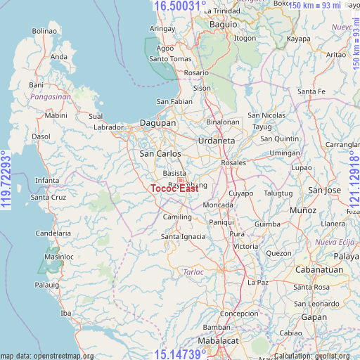
Tococ East GPS coordinates[2]
15° 49' 29.928" North, 120° 25' 33.78" East
| Map corner | latitude | longitude |
|---|---|---|
| Upper-left | 16.50031°, | 119.72293° |
| Center: | 15.82498°, | 120.42605° |
| Lower-right: | 15.14739°, | 121.12918° |
| Map W x H: | 150.4×150.4 km | = 93.5×93.5mi |
| max Lat: | 20.78733° ⇑14.9% North |
| Tococ East: | 15.82498° |
| min Lat: | ⇓85.1% South 4.65442° |
| min Long | Tococ East | max Long |
| 117.04868° | 120.42605° | 126.58417° |
| W 7%⇐ | ⇒93% E |
Elevation
Elevation of Tococ East is 18 m = 59 ft, and this is 69.9 m = 229 ft below average elevation for this country.
| Max E: |
2262 m = 7421 ft | 57.6% |
| Avg. | 87.9 m = 288 ft | |
| Tococ East | 18 m = 59 ft | |
Min E: |
-2 m = -7 ft | 42.4% |
See also: Philippines elevation on elevation.city.
Geographical zone
Tococ East is located in North Torrid zone (between Equator and Tropic of Cancer). Distance of this Northern Tropic circle is 846.3 km =525.9 mi to North.| Distance of | km | miles | from Tococ East |
|---|---|---|---|
| North Pole | 8247.5 | 5124.8 | to North |
| Arctic Circle | 5641.6 | 3505.5 | to North |
| Tropic Cancer | 846.3 | 525.9 | to North |
| Equator | 1759.6 | 1093.4 | to South |


Nearby cities:
15 places around Tococ East: (largest is in red/bold)
• Anambongan
6.1 km =3.8 mi,  318°
318°
• Anulid
6.7 km =4.2 mi,  89°
89°
• Baluyot
4.9 km =3 mi,  130°
130°
• Basista
4.3 km =2.7 mi, 315°
• Bayambang
3.5 km =2.2 mi,  113°
113°
• Bical Norte
1.5 km =0.9 mi,  139°
139°
• Don Pedro
6.7 km =4.2 mi,  3°
3°
• Dumpay
7.6 km =4.7 mi,  328°
328°
• Lepa
7.1 km =4.4 mi,  21°
21°
• Nalsian Norte
3.4 km =2.1 mi,  50°
50°
• Navatat
4.7 km =2.9 mi,  305°
305°
• Olea
8.3 km =5.2 mi,  60°
60°
• Pasibi West
6.2 km =3.9 mi, 306°
• San Gabriel First
7.3 km =4.5 mi,  153°
153°
• Tanolong
2.6 km =1.6 mi,  208°
208°
Sources, notices
• [Note1] Compared only with cities in Philippines existing in our database
• [Src1] Map data: © OpenStreetMap contributors (CC-BY-SA)
• [Src2] Other city data from geonames.org with taken over terms of usage.
• [Src3] Geographical zone / Annual Mean Temperature by Robert A. Rohde @ Wikipedia
