Nalsian Norte geodata
Nalsian Norte (Ilocos) is a populated place; located in Philippines in Asia/Manila (GMT+8) time zone. With population of 3,157 people, there are 2348 cities with bigger population in this country. Compared to other cities in Philippines, 85.4% of cities are located further ↓South; 92.2% of cities are located further →East and 51.8% of cities have higher elevation than Nalsian Norte. Note1


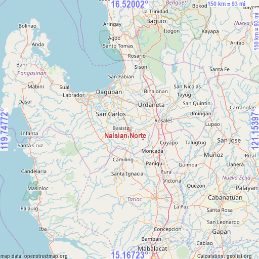
Nalsian Norte GPS coordinates[2]
15° 50' 41.136" North, 120° 27' 3.024" East
| Map corner | latitude | longitude |
|---|---|---|
| Upper-left | 16.52002°, | 119.74772° |
| Center: | 15.84476°, | 120.45084° |
| Lower-right: | 15.16723°, | 121.15397° |
| Map W x H: | 150.4×150.4 km | = 93.5×93.5mi |
| max Lat: | 20.78733° ⇑14.6% North |
| Nalsian Norte: | 15.84476° |
| min Lat: | ⇓85.4% South 4.65442° |
| min Long | Nalsian Norte | max Long |
| 117.04868° | 120.45084° | 126.58417° |
| W 7.8%⇐ | ⇒92.2% E |
Elevation
Elevation of Nalsian Norte is 22 m = 72 ft, and this is 65.9 m = 216 ft below average elevation for this country.
| Max E: |
2262 m = 7421 ft | 51.8% |
| Avg. | 87.9 m = 288 ft | |
| Nalsian Norte | 22 m = 72 ft | |
Min E: |
-2 m = -7 ft | 48.2% |
See also: Philippines elevation on elevation.city.
Geographical zone
Nalsian Norte is located in North Torrid zone (between Equator and Tropic of Cancer). Distance of this Northern Tropic circle is 844.1 km =524.5 mi to North.| Distance of | km | miles | from Nalsian Norte |
|---|---|---|---|
| North Pole | 8245.3 | 5123.4 | to North |
| Arctic Circle | 5639.4 | 3504.2 | to North |
| Tropic Cancer | 844.1 | 524.5 | to North |
| Equator | 1761.8 | 1094.7 | to South |


Nearby cities:
15 places around Nalsian Norte: (largest is in red/bold)
• Anambongan
7.1 km =4.4 mi,  289°
289°
• Anulid
4.5 km =2.8 mi,  117°
117°
• Baluyot
5.5 km =3.4 mi,  168°
168°
• Basista
5.8 km =3.6 mi,  278°
278°
• Bayambang
3.6 km =2.2 mi, 171°
• Bical Norte
3.7 km =2.3 mi,  206°
206°
• Buenlag
6.7 km =4.2 mi,  104°
104°
• Canan Norte
7.8 km =4.8 mi,  21°
21°
• Don Pedro
5 km =3.1 mi,  334°
334°
• Lepa
4.4 km =2.7 mi,  0°
0°
• Navatat
6.5 km =4 mi,  274°
274°
• Olea
5 km =3.1 mi,  66°
66°
• Polong Norte
7.2 km =4.5 mi, 334°
• Tanolong
6 km =3.7 mi,  221°
221°
• Tococ East
3.4 km =2.1 mi,  230°
230°
Sources, notices
• [Note1] Compared only with cities in Philippines existing in our database
• [Src1] Map data: © OpenStreetMap contributors (CC-BY-SA)
• [Src2] Other city data from geonames.org with taken over terms of usage.
• [Src3] Geographical zone / Annual Mean Temperature by Robert A. Rohde @ Wikipedia
