Olea geodata
Olea (Ilocos) is a populated place; located in Philippines in Asia/Manila (GMT+8) time zone. With population of 2,434 people, there are 3406 cities with bigger population in this country. Compared to other cities in Philippines, 85.7% of cities are located further ↓South; 90.9% of cities are located further →East and 51.1% of cities have lower elevation than Olea. Note1


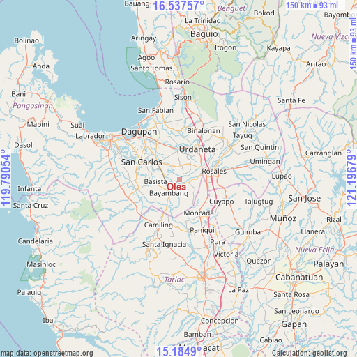
Olea GPS coordinates[2]
15° 51' 44.532" North, 120° 29' 37.176" East
| Map corner | latitude | longitude |
|---|---|---|
| Upper-left | 16.53757°, | 119.79054° |
| Center: | 15.86237°, | 120.49366° |
| Lower-right: | 15.1849°, | 121.19679° |
| Map W x H: | 150.4×150.4 km | = 93.5×93.5mi |
| max Lat: | 20.78733° ⇑14.3% North |
| Olea: | 15.86237° |
| min Lat: | ⇓85.7% South 4.65442° |
| min Long | Olea | max Long |
| 117.04868° | 120.49366° | 126.58417° |
| W 9.1%⇐ | ⇒90.9% E |
Elevation
Elevation of Olea is 24 m = 79 ft, and this is 63.9 m = 210 ft below average elevation for this country.
| Max E: |
2262 m = 7421 ft | 48.9% |
| Avg. | 87.9 m = 288 ft | |
| Olea | 24 m = 79 ft | |
Min E: |
-2 m = -7 ft | 51.1% |
See also: Philippines elevation on elevation.city.
Geographical zone
Olea is located in North Torrid zone (between Equator and Tropic of Cancer). Distance of this Northern Tropic circle is 842.2 km =523.3 mi to North.| Distance of | km | miles | from Olea |
|---|---|---|---|
| North Pole | 8243.3 | 5122.1 | to North |
| Arctic Circle | 5637.4 | 3502.9 | to North |
| Tropic Cancer | 842.2 | 523.3 | to North |
| Equator | 1763.7 | 1095.9 | to South |


Nearby cities:
15 places around Olea: (largest is in red/bold)
• Alcala
3.7 km =2.3 mi,  117°
117°
• Anulid
4.1 km =2.5 mi,  187°
187°
• Bacundao Weste
6.2 km =3.9 mi,  342°
342°
• Baluyot
8.2 km =5.1 mi,  205°
205°
• Barangobong
6.1 km =3.8 mi,  73°
73°
• Bayambang
6.9 km =4.3 mi,  216°
216°
• Buenlag
4.1 km =2.5 mi,  152°
152°
• Canan Norte
5.6 km =3.5 mi, 342°
• Capulaan
6.6 km =4.1 mi,  44°
44°
• Don Pedro
7.2 km =4.5 mi,  290°
290°
• Lepa
5.2 km =3.2 mi,  298°
298°
• Nalsian Norte
5 km =3.1 mi,  246°
246°
• Pindangan Centro
6.2 km =3.9 mi,  91°
91°
• San Pedro Apartado
8.2 km =5.1 mi,  110°
110°
• Unzad
7.9 km =4.9 mi, 37°
Sources, notices
• [Note1] Compared only with cities in Philippines existing in our database
• [Src1] Map data: © OpenStreetMap contributors (CC-BY-SA)
• [Src2] Other city data from geonames.org with taken over terms of usage.
• [Src3] Geographical zone / Annual Mean Temperature by Robert A. Rohde @ Wikipedia
