San Gabriel First geodata
San Gabriel First (Ilocos) is a populated place; located in Philippines in Asia/Manila (GMT+8) time zone. With population of 2,992 people, there are 2533 cities with bigger population in this country. Compared to other cities in Philippines, 84.5% of cities are located further ↓South; 92% of cities are located further →East and 54.5% of cities have higher elevation than San Gabriel First. Note1


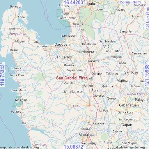
San Gabriel First GPS coordinates[2]
15° 45' 59.4" North, 120° 27' 23.58" East
| Map corner | latitude | longitude |
|---|---|---|
| Upper-left | 16.44203°, | 119.75343° |
| Center: | 15.7665°, | 120.45655° |
| Lower-right: | 15.08872°, | 121.15968° |
| Map W x H: | 150.5×150.5 km | = 93.5×93.5mi |
| max Lat: | 20.78733° ⇑15.5% North |
| San Gabriel First: | 15.7665° |
| min Lat: | ⇓84.5% South 4.65442° |
| min Long | San Gabriel Fir | max Long |
| 117.04868° | 120.45655° | 126.58417° |
| W 8%⇐ | ⇒92% E |
Elevation
Elevation of San Gabriel First is 20 m = 66 ft, and this is 67.9 m = 223 ft below average elevation for this country.
| Max E: |
2262 m = 7421 ft | 54.5% |
| Avg. | 87.9 m = 288 ft | |
| San Gabriel First | 20 m = 66 ft | |
Min E: |
-2 m = -7 ft | 45.5% |
See also: Philippines elevation on elevation.city.
Geographical zone
San Gabriel First is located in North Torrid zone (between Equator and Tropic of Cancer). Distance of this Northern Tropic circle is 852.8 km =529.9 mi to North.| Distance of | km | miles | from San Gabriel First |
|---|---|---|---|
| North Pole | 8254 | 5128.8 | to North |
| Arctic Circle | 5648.1 | 3509.6 | to North |
| Tropic Cancer | 852.8 | 529.9 | to North |
| Equator | 1753.1 | 1089.3 | to South |


Nearby cities:
15 places around San Gabriel First: (largest is in red/bold)
• Anulid
7.4 km =4.6 mi,  27°
27°
• Bacabac
5.5 km =3.4 mi,  213°
213°
• Baluyot
3.3 km =2.1 mi,  8°
8°
• Bautista
4.9 km =3 mi,  67°
67°
• Bayambang
5.1 km =3.2 mi,  358°
358°
• Bical Norte
5.8 km =3.6 mi,  336°
336°
• Bilad
4.1 km =2.5 mi,  217°
217°
• Buenlag
9.2 km =5.7 mi,  39°
39°
• Camiling
10 km =6.2 mi, 207°
• Nalsian Norte
8.7 km =5.4 mi, 355°
• Sapang
10.1 km =6.3 mi,  134°
134°
• Sinilian First
8.1 km =5 mi,  177°
177°
• Tanolong
6.2 km =3.9 mi,  312°
312°
• Tococ East
7.3 km =4.5 mi,  333°
333°
• Villanueva
10.3 km =6.4 mi, 69°
Sources, notices
• [Note1] Compared only with cities in Philippines existing in our database
• [Src1] Map data: © OpenStreetMap contributors (CC-BY-SA)
• [Src2] Other city data from geonames.org with taken over terms of usage.
• [Src3] Geographical zone / Annual Mean Temperature by Robert A. Rohde @ Wikipedia
