Ternate geodata
Ternate (Calabarzon) is a seat of a third-order administrative division; located in Philippines in Asia/Manila (GMT+8) time zone. With population of 20,049 people, there are 369 cities with bigger population in this country. Compared to other cities in Philippines, 72.8% of cities are located further ↓South; 84.5% of cities are located further →East and 80.7% of cities have higher elevation than Ternate. Note1


Ternate GPS coordinates[2]
14° 17' 22.92" North, 120° 43' 0.48" East
| Map corner | latitude | longitude |
|---|---|---|
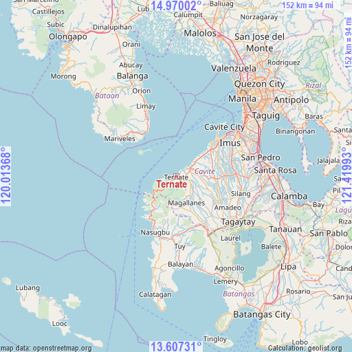
| Upper-left | 14.97002°, | 120.01368° |
| Center: | 14.2897°, | 120.7168° |
| Lower-right: | 13.60731°, | 121.41993° |
| Map W x H: | 151.5×151.5 km | = 94.1×94.1mi |
| max Lat: | 20.78733° ⇑27.2% North |
| Ternate: | 14.2897° |
| min Lat: | ⇓72.8% South 4.65442° |
| min Long | Ternate | max Long |
| 117.04868° | 120.7168° | 126.58417° |
| W 15.5%⇐ | ⇒84.5% E |
Elevation
Elevation of Ternate is 9 m = 30 ft, and this is 78.9 m = 259 ft below average elevation for this country.
| Max E: |
2262 m = 7421 ft | 80.7% |
| Avg. | 87.9 m = 288 ft | |
| Ternate | 9 m = 30 ft | |
Min E: |
-2 m = -7 ft | 19.3% |
See also: Philippines elevation on elevation.city.
Geographical zone
Ternate is located in North Torrid zone (between Equator and Tropic of Cancer). Distance of this Northern Tropic circle is 1017.1 km =632 mi to North.| Distance of | km | miles | from Ternate |
|---|---|---|---|
| North Pole | 8418.2 | 5230.8 | to North |
| Arctic Circle | 5812.3 | 3611.6 | to North |
| Tropic Cancer | 1017.1 | 632 | to North |
| Equator | 1588.9 | 987.3 | to South |


Nearby cities:
15 places around Ternate: (largest is in red/bold)
• Banaba
16.5 km =10.3 mi,  119°
119°
• Batas
14.7 km =9.1 mi,  132°
132°
• Bulihan
16.8 km =10.4 mi,  207°
207°
• General Emilio Aguinaldo
14.5 km =9 mi,  144°
144°
• Halayhay
14 km =8.7 mi,  48°
48°
• Looc
16.8 km =10.4 mi, 214°
• Magallanes
12.1 km =7.5 mi,  158°
158°
• Malainen Luma
8 km =5 mi,  105°
105°
• Maragondon
2.9 km =1.8 mi, 128°
• Naic
6.2 km =3.9 mi,  59°
59°
• Palangue
10.2 km =6.3 mi,  93°
93°
• Pantijan No 2
11 km =6.8 mi, 124°
• Paradahan
15.9 km =9.9 mi,  77°
77°
• Sabang
9.5 km =5.9 mi, 79°
• Tulay
6.1 km =3.8 mi, 111°
Sources, notices
• [Note1] Compared only with cities in Philippines existing in our database
• [Src1] Map data: © OpenStreetMap contributors (CC-BY-SA)
• [Src2] Other city data from geonames.org with taken over terms of usage.
• [Src3] Geographical zone / Annual Mean Temperature by Robert A. Rohde @ Wikipedia
