Batas geodata
Batas (Calabarzon) is a populated place; located in Philippines in Asia/Manila (GMT+8) time zone. With population of 2,591 people, there are 3125 cities with bigger population in this country. Compared to other cities in Philippines, 71.9% of cities are located further ↓South; 81.8% of cities are located further →East and 89% of cities have lower elevation than Batas. Note1


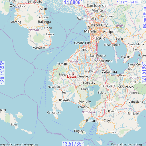
Batas GPS coordinates[2]
14° 12' 0" North, 120° 49' 0.012" East
| Map corner | latitude | longitude |
|---|---|---|
| Upper-left | 14.8806°, | 120.11355° |
| Center: | 14.2°, | 120.81667° |
| Lower-right: | 13.51735°, | 121.5198° |
| Map W x H: | 151.6×151.6 km | = 94.2×94.2mi |
| max Lat: | 20.78733° ⇑28.1% North |
| Batas: | 14.2° |
| min Lat: | ⇓71.9% South 4.65442° |
| min Long | Batas | max Long |
| 117.04868° | 120.81667° | 126.58417° |
| W 18.2%⇐ | ⇒81.8% E |
Elevation
Elevation of Batas is 201 m = 659 ft, and this is 113.1 m = 371 ft above average elevation for this country.
| Max E: |
2262 m = 7421 ft | 11% |
| Batas | 201 m 659 ft | |
| Avg. | 87.9 m = 288 ft | |
Min E: |
-2 m = -7 ft | 89% |
See also: Philippines elevation on elevation.city.
Geographical zone
Batas is located in North Torrid zone (between Equator and Tropic of Cancer). Distance of this Northern Tropic circle is 1027 km =638.1 mi to North.| Distance of | km | miles | from Batas |
|---|---|---|---|
| North Pole | 8428.2 | 5237 | to North |
| Arctic Circle | 5822.3 | 3617.8 | to North |
| Tropic Cancer | 1027 | 638.1 | to North |
| Equator | 1578.9 | 981.1 | to South |


Nearby cities:
15 places around Batas: (largest is in red/bold)
• Alfonso
7.7 km =4.8 mi,  148°
148°
• Banaba
4 km =2.5 mi,  62°
62°
• Bitangan
8.9 km =5.5 mi,  47°
47°
• General Emilio Aguinaldo
2.9 km =1.8 mi,  231°
231°
• Guyam Malaki
7.1 km =4.4 mi,  137°
137°
• Indang
6.5 km =4 mi,  94°
94°
• Kaytitinga
10.4 km =6.5 mi,  172°
172°
• Magallanes
6.5 km =4 mi,  258°
258°
• Malainen Luma
8.4 km =5.2 mi,  338°
338°
• Matagbak
8 km =5 mi, 165°
• Palangue
9.4 km =5.8 mi,  356°
356°
• Pangil
9.8 km =6.1 mi, 89°
• Pantijan No 2
4.1 km =2.5 mi,  334°
334°
• Taywanak Ilaya
5.7 km =3.5 mi, 145°
• Tulay
9.3 km =5.8 mi, 326°
Sources, notices
• [Note1] Compared only with cities in Philippines existing in our database
• [Src1] Map data: © OpenStreetMap contributors (CC-BY-SA)
• [Src2] Other city data from geonames.org with taken over terms of usage.
• [Src3] Geographical zone / Annual Mean Temperature by Robert A. Rohde @ Wikipedia
