Naic geodata
Naic (Calabarzon) is a seat of a third-order administrative division; located in Philippines in Asia/Manila (GMT+8) time zone. With population of 55,195 people, there are 167 cities with bigger population in this country. Compared to other cities in Philippines, 73.1% of cities are located further ↓South; 83.3% of cities are located further →East and 62.8% of cities have higher elevation than Naic. Note1


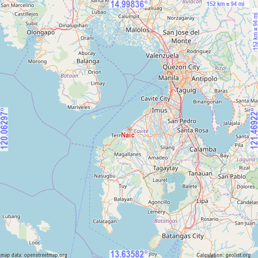
Naic GPS coordinates[2]
14° 19' 5.232" North, 120° 45' 57.924" East
| Map corner | latitude | longitude |
|---|---|---|
| Upper-left | 14.99836°, | 120.06297° |
| Center: | 14.31812°, | 120.76609° |
| Lower-right: | 13.63582°, | 121.46922° |
| Map W x H: | 151.5×151.5 km | = 94.1×94.1mi |
| max Lat: | 20.78733° ⇑26.9% North |
| Naic: | 14.31812° |
| min Lat: | ⇓73.1% South 4.65442° |
| min Long | Naic | max Long |
| 117.04868° | 120.76609° | 126.58417° |
| W 16.7%⇐ | ⇒83.3% E |
Elevation
Elevation of Naic is 15 m = 49 ft, and this is 72.9 m = 239 ft below average elevation for this country.
| Max E: |
2262 m = 7421 ft | 62.8% |
| Avg. | 87.9 m = 288 ft | |
| Naic | 15 m = 49 ft | |
Min E: |
-2 m = -7 ft | 37.2% |
See also: Naic elevation on elevation.city.
Geographical zone
Naic is located in North Torrid zone (between Equator and Tropic of Cancer). Distance of this Northern Tropic circle is 1013.9 km =630 mi to North.| Distance of | km | miles | from Naic |
|---|---|---|---|
| North Pole | 8415 | 5228.8 | to North |
| Arctic Circle | 5809.1 | 3609.6 | to North |
| Tropic Cancer | 1013.9 | 630 | to North |
| Equator | 1592 | 989.2 | to South |


Nearby cities:
15 places around Naic: (largest is in red/bold)
• Aliang
13.2 km =8.2 mi,  107°
107°
• Batas
14.2 km =8.8 mi,  157°
157°
• Bitangan
14 km =8.7 mi,  120°
120°
• Halayhay
8 km =5 mi,  39°
39°
• Kanluran
14.2 km =8.8 mi, 39°
• Malainen Luma
5.8 km =3.6 mi, 155°
• Maragondon
5.8 km =3.6 mi,  211°
211°
• Palangue
6.2 km =3.9 mi,  127°
127°
• Pantijan No 2
10.2 km =6.3 mi, 158°
• Paradahan
10.2 km =6.3 mi,  88°
88°
• Pasong Kawayan Primero
12.7 km =7.9 mi,  77°
77°
• Sabang
4.3 km =2.7 mi, 109°
• Tanza
13.1 km =8.1 mi,  47°
47°
• Ternate
6.2 km =3.9 mi,  239°
239°
• Tulay
5.4 km =3.4 mi,  176°
176°
Sources, notices
• [Note1] Compared only with cities in Philippines existing in our database
• [Src1] Map data: © OpenStreetMap contributors (CC-BY-SA)
• [Src2] Other city data from geonames.org with taken over terms of usage.
• [Src3] Geographical zone / Annual Mean Temperature by Robert A. Rohde @ Wikipedia
