Santa Josefa geodata
Santa Josefa (Caraga) is a seat of a third-order administrative division; located in Philippines in Asia/Manila (GMT+8) time zone. With population of 4,164 people, there are 1636 cities with bigger population in this country. Compared to other cities in Philippines, 82.9% of cities are located further ↑North; 98% of cities are located further ←West and 61.5% of cities have lower elevation than Santa Josefa. Note1
Administrative division(s):
- Level 1: Caraga
- Level 2: Province of Agusan del Sur
- Level 3: Santa Josefa


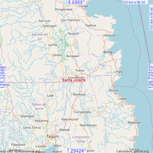
Santa Josefa GPS coordinates[2]
7° 59' 27.996" North, 126° 1' 48" East
| Map corner | latitude | longitude |
|---|---|---|
| Upper-left | 8.6868°, | 125.32688° |
| Center: | 7.99111°, | 126.03° |
| Lower-right: | 7.29424°, | 126.73313° |
| Map W x H: | 154.8×154.8 km | = 96.2×96.2mi |
| max Lat: | 20.78733° ⇑82.9% North |
| Santa Josefa: | 7.99111° |
| min Lat: | ⇓17.1% South 4.65442° |
| min Long | Santa Josefa | max Long |
| 117.04868° | 126.03° | 126.58417° |
| W 98%⇐ | ⇒2% E |
Elevation
Elevation of Santa Josefa is 36 m = 118 ft, and this is 51.9 m = 170 ft below average elevation for this country.
| Max E: |
2262 m = 7421 ft | 38.5% |
| Avg. | 87.9 m = 288 ft | |
| Santa Josefa | 36 m = 118 ft | |
Min E: |
-2 m = -7 ft | 61.5% |
See also: Philippines elevation on elevation.city.
Geographical zone
Santa Josefa is located in North Torrid zone (between Equator and Tropic of Cancer). Distance of Equator is 888.5 km =552.1 mi to South.| Distance of | km | miles | from Santa Josefa |
|---|---|---|---|
| North Pole | 9118.5 | 5666 | to North |
| Arctic Circle | 6512.6 | 4046.7 | to North |
| Tropic Cancer | 1717.4 | 1067.1 | to North |
| Equator | 888.5 | 552.1 | to South |


Nearby cities:
15 places around Santa Josefa: (largest is in red/bold)
• Babag
29 km =18 mi,  170°
170°
• Basa
9.8 km =6.1 mi,  22°
22°
• Baylo
15.4 km =9.6 mi, 169°
• Bunawan
20.1 km =12.5 mi,  347°
347°
• Cuevas
7.7 km =4.8 mi,  66°
66°
• Libertad
12.9 km =8 mi,  358°
358°
• Loreto
29.2 km =18.1 mi,  318°
318°
• Monkayo
19.7 km =12.2 mi, 172°
• Pasian
8.1 km =5 mi,  149°
149°
• Salvacion
10.5 km =6.5 mi,  84°
84°
• Santa Maria
15.3 km =9.5 mi, 72°
• Sinubong
13.9 km =8.6 mi,  308°
308°
• Tapia
26.4 km =16.4 mi,  184°
184°
• Trento
7.1 km =4.4 mi,  31°
31°
• Veruela
12.2 km =7.6 mi, 318°
Sources, notices
• [Note1] Compared only with cities in Philippines existing in our database
• [Src1] Map data: © OpenStreetMap contributors (CC-BY-SA)
• [Src2] Other city data from geonames.org with taken over terms of usage.
• [Src3] Geographical zone / Annual Mean Temperature by Robert A. Rohde @ Wikipedia
