San Rafael geodata
San Rafael (Central Luzon) is a seat of a third-order administrative division; located in Philippines in Asia/Manila (GMT+8) time zone. In our database, there are 4166 cities with bigger population. Compared to other cities in Philippines, 76.9% of cities are located further ↓South; 77.5% of cities are located further →East and 55.6% of cities have lower elevation than San Rafael. Note1


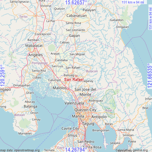
San Rafael GPS coordinates[2]
14° 56' 53.988" North, 120° 57' 43.992" East
| Map corner | latitude | longitude |
|---|---|---|
| Upper-left | 15.62657°, | 120.2591° |
| Center: | 14.94833°, | 120.96222° |
| Lower-right: | 14.26794°, | 121.66535° |
| Map W x H: | 151.1×151.1 km | = 93.9×93.9mi |
| max Lat: | 20.78733° ⇑23.1% North |
| San Rafael: | 14.94833° |
| min Lat: | ⇓76.9% South 4.65442° |
| min Long | San Rafael | max Long |
| 117.04868° | 120.96222° | 126.58417° |
| W 22.5%⇐ | ⇒77.5% E |
Elevation
Elevation of San Rafael is 28 m = 92 ft, and this is 59.9 m = 197 ft below average elevation for this country.
| Max E: |
2262 m = 7421 ft | 44.4% |
| Avg. | 87.9 m = 288 ft | |
| San Rafael | 28 m = 92 ft | |
Min E: |
-2 m = -7 ft | 55.6% |
See also: Philippines elevation on elevation.city.
Geographical zone
San Rafael is located in North Torrid zone (between Equator and Tropic of Cancer). Distance of this Northern Tropic circle is 943.8 km =586.4 mi to North.| Distance of | km | miles | from San Rafael |
|---|---|---|---|
| North Pole | 8345 | 5185.3 | to North |
| Arctic Circle | 5739.1 | 3566.1 | to North |
| Tropic Cancer | 943.8 | 586.4 | to North |
| Equator | 1662.1 | 1032.8 | to South |


Nearby cities:
15 places around San Rafael: (largest is in red/bold)
• Angat
7.6 km =4.7 mi,  106°
106°
• Bagong Barrio
6.9 km =4.3 mi,  199°
199°
• Baliuag
7 km =4.3 mi,  275°
275°
• Bustos
4.9 km =3 mi, 282°
• Culianin
7.8 km =4.8 mi,  241°
241°
• Diliman Primero
8.6 km =5.3 mi,  352°
352°
• Liciada
5 km =3.1 mi,  221°
221°
• Maasim
9 km =5.6 mi,  54°
54°
• Maguinao
8.8 km =5.5 mi,  339°
339°
• Niugan
0.6 km =0.4 mi,  115°
115°
• Pandi
9.3 km =5.8 mi,  183°
183°
• Pantubig
2.3 km =1.4 mi, 339°
• Pulo
5.8 km =3.6 mi,  74°
74°
• San Roque
7.3 km =4.5 mi, 339°
• Upig
9.2 km =5.7 mi,  20°
20°
Sources, notices
• [Note1] Compared only with cities in Philippines existing in our database
• [Src1] Map data: © OpenStreetMap contributors (CC-BY-SA)
• [Src2] Other city data from geonames.org with taken over terms of usage.
• [Src3] Geographical zone / Annual Mean Temperature by Robert A. Rohde @ Wikipedia
