Maasim geodata
Maasim (Central Luzon) is a populated place; located in Philippines in Asia/Manila (GMT+8) time zone. With population of 3,577 people, there are 2001 cities with bigger population in this country. Compared to other cities in Philippines, 77.4% of cities are located further ↓South; 75.7% of cities are located further →East and 74.6% of cities have lower elevation than Maasim. Note1


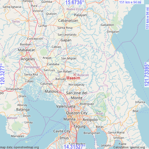
Maasim GPS coordinates[2]
14° 59' 43.836" North, 121° 1' 50.952" East
| Map corner | latitude | longitude |
|---|---|---|
| Upper-left | 15.6736°, | 120.3277° |
| Center: | 14.99551°, | 121.03082° |
| Lower-right: | 14.31527°, | 121.73395° |
| Map W x H: | 151×151 km | = 93.8×93.8mi |
| max Lat: | 20.78733° ⇑22.6% North |
| Maasim: | 14.99551° |
| min Lat: | ⇓77.4% South 4.65442° |
| min Long | Maasim | max Long |
| 117.04868° | 121.03082° | 126.58417° |
| W 24.3%⇐ | ⇒75.7% E |
Elevation
Elevation of Maasim is 67 m = 220 ft, and this is 20.9 m = 69 ft below average elevation for this country.
| Max E: |
2262 m = 7421 ft | 25.4% |
| Avg. | 87.9 m = 288 ft | |
| Maasim | 67 m = 220 ft | |
Min E: |
-2 m = -7 ft | 74.6% |
See also: Philippines elevation on elevation.city.
Geographical zone
Maasim is located in North Torrid zone (between Equator and Tropic of Cancer). Distance of this Northern Tropic circle is 938.6 km =583.2 mi to North.| Distance of | km | miles | from Maasim |
|---|---|---|---|
| North Pole | 8339.7 | 5182 | to North |
| Arctic Circle | 5733.8 | 3562.8 | to North |
| Tropic Cancer | 938.6 | 583.2 | to North |
| Equator | 1667.3 | 1036 | to South |


Nearby cities:
15 places around Maasim: (largest is in red/bold)
• Akle
7.4 km =4.6 mi,  37°
37°
• Angat
7.5 km =4.7 mi,  180°
180°
• Bituñgol
12.5 km =7.8 mi, 178°
• Bustos
12.8 km =8 mi,  251°
251°
• Diliman Primero
9.1 km =5.7 mi,  290°
290°
• Doña Remedios Trinidad
5.7 km =3.5 mi,  84°
84°
• Maguinao
10.8 km =6.7 mi, 286°
• Niugan
8.8 km =5.5 mi,  231°
231°
• Norzagaray
9.6 km =6 mi,  168°
168°
• Pantubig
8.7 km =5.4 mi, 249°
• Pulo
4.1 km =2.5 mi,  205°
205°
• Pulong Sampalok
5 km =3.1 mi,  139°
139°
• San Rafael
9 km =5.6 mi, 234°
• San Roque
10.1 km =6.3 mi,  278°
278°
• Upig
5.3 km =3.3 mi,  308°
308°
Sources, notices
• [Note1] Compared only with cities in Philippines existing in our database
• [Src1] Map data: © OpenStreetMap contributors (CC-BY-SA)
• [Src2] Other city data from geonames.org with taken over terms of usage.
• [Src3] Geographical zone / Annual Mean Temperature by Robert A. Rohde @ Wikipedia
