Niugan geodata
Niugan (Central Luzon) is a populated place; located in Philippines in Asia/Manila (GMT+8) time zone. With population of 4,014 people, there are 1719 cities with bigger population in this country. Compared to other cities in Philippines, 76.9% of cities are located further ↓South; 77.2% of cities are located further →East and 55.6% of cities have lower elevation than Niugan. Note1


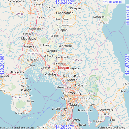
Niugan GPS coordinates[2]
14° 56' 45.852" North, 120° 58' 1.92" East
| Map corner | latitude | longitude |
|---|---|---|
| Upper-left | 15.62432°, | 120.26408° |
| Center: | 14.94607°, | 120.9672° |
| Lower-right: | 14.26567°, | 121.67033° |
| Map W x H: | 151.1×151.1 km | = 93.9×93.9mi |
| max Lat: | 20.78733° ⇑23.1% North |
| Niugan: | 14.94607° |
| min Lat: | ⇓76.9% South 4.65442° |
| min Long | Niugan | max Long |
| 117.04868° | 120.9672° | 126.58417° |
| W 22.8%⇐ | ⇒77.2% E |
Elevation
Elevation of Niugan is 28 m = 92 ft, and this is 59.9 m = 197 ft below average elevation for this country.
| Max E: |
2262 m = 7421 ft | 44.4% |
| Avg. | 87.9 m = 288 ft | |
| Niugan | 28 m = 92 ft | |
Min E: |
-2 m = -7 ft | 55.6% |
See also: Philippines elevation on elevation.city.
Geographical zone
Niugan is located in North Torrid zone (between Equator and Tropic of Cancer). Distance of this Northern Tropic circle is 944.1 km =586.6 mi to North.| Distance of | km | miles | from Niugan |
|---|---|---|---|
| North Pole | 8345.2 | 5185.5 | to North |
| Arctic Circle | 5739.3 | 3566.2 | to North |
| Tropic Cancer | 944.1 | 586.6 | to North |
| Equator | 1661.8 | 1032.6 | to South |


Nearby cities:
15 places around Niugan: (largest is in red/bold)
• Angat
7 km =4.3 mi,  106°
106°
• Bagong Barrio
6.8 km =4.2 mi,  204°
204°
• Baliuag
7.6 km =4.7 mi,  277°
277°
• Bustos
5.5 km =3.4 mi, 284°
• Culianin
8.1 km =5 mi,  245°
245°
• Diliman Primero
8.9 km =5.5 mi,  349°
349°
• Liciada
5.1 km =3.2 mi,  227°
227°
• Maasim
8.8 km =5.5 mi,  51°
51°
• Maguinao
9.2 km =5.7 mi,  337°
337°
• Pandi
9.1 km =5.7 mi,  186°
186°
• Pantubig
2.8 km =1.7 mi,  331°
331°
• Pulo
5.4 km =3.4 mi,  70°
70°
• San Rafael
0.6 km =0.4 mi,  295°
295°
• San Roque
7.7 km =4.8 mi, 336°
• Upig
9.2 km =5.7 mi,  16°
16°
Sources, notices
• [Note1] Compared only with cities in Philippines existing in our database
• [Src1] Map data: © OpenStreetMap contributors (CC-BY-SA)
• [Src2] Other city data from geonames.org with taken over terms of usage.
• [Src3] Geographical zone / Annual Mean Temperature by Robert A. Rohde @ Wikipedia
