Bagong Barrio geodata
Bagong Barrio (Central Luzon) is a populated place; located in Philippines in Asia/Manila (GMT+8) time zone. With population of 4,205 people, there are 1627 cities with bigger population in this country. Compared to other cities in Philippines, 76.3% of cities are located further ↓South; 78% of cities are located further →East and 52.3% of cities have lower elevation than Bagong Barrio. Note1


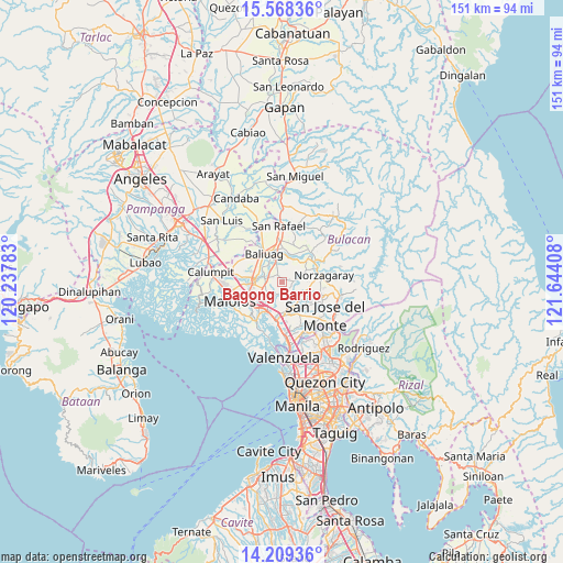
Bagong Barrio GPS coordinates[2]
14° 53' 23.748" North, 120° 56' 27.42" East
| Map corner | latitude | longitude |
|---|---|---|
| Upper-left | 15.56836°, | 120.23783° |
| Center: | 14.88993°, | 120.94095° |
| Lower-right: | 14.20936°, | 121.64408° |
| Map W x H: | 151.1×151.1 km | = 93.9×93.9mi |
| max Lat: | 20.78733° ⇑23.7% North |
| Bagong Barrio: | 14.88993° |
| min Lat: | ⇓76.3% South 4.65442° |
| min Long | Bagong Barrio | max Long |
| 117.04868° | 120.94095° | 126.58417° |
| W 22%⇐ | ⇒78% E |
Elevation
Elevation of Bagong Barrio is 25 m = 82 ft, and this is 62.9 m = 206 ft below average elevation for this country.
| Max E: |
2262 m = 7421 ft | 47.7% |
| Avg. | 87.9 m = 288 ft | |
| Bagong Barrio | 25 m = 82 ft | |
Min E: |
-2 m = -7 ft | 52.3% |
See also: Philippines elevation on elevation.city.
Geographical zone
Bagong Barrio is located in North Torrid zone (between Equator and Tropic of Cancer). Distance of this Northern Tropic circle is 950.3 km =590.5 mi to North.| Distance of | km | miles | from Bagong Barrio |
|---|---|---|---|
| North Pole | 8351.5 | 5189.4 | to North |
| Arctic Circle | 5745.6 | 3570.1 | to North |
| Tropic Cancer | 950.3 | 590.5 | to North |
| Equator | 1655.6 | 1028.7 | to South |


Nearby cities:
15 places around Bagong Barrio: (largest is in red/bold)
• Balasing
8.7 km =5.4 mi,  117°
117°
• Baliuag
8.6 km =5.3 mi,  326°
326°
• Bulihan
5.1 km =3.2 mi,  252°
252°
• Bustos
8 km =5 mi,  341°
341°
• Culianin
5.4 km =3.4 mi,  301°
301°
• Guiguinto
8.8 km =5.5 mi,  224°
224°
• Guyong
7.2 km =4.5 mi,  146°
146°
• Liciada
2.9 km =1.8 mi, 340°
• Manatal
3 km =1.9 mi,  241°
241°
• Niugan
6.8 km =4.2 mi,  24°
24°
• Pandi
3.3 km =2.1 mi, 147°
• Pantubig
8.8 km =5.5 mi,  9°
9°
• Pulong Gubat
5.1 km =3.2 mi,  227°
227°
• San Rafael
6.9 km =4.3 mi, 19°
• Santa Maria
8.1 km =5 mi,  162°
162°
Sources, notices
• [Note1] Compared only with cities in Philippines existing in our database
• [Src1] Map data: © OpenStreetMap contributors (CC-BY-SA)
• [Src2] Other city data from geonames.org with taken over terms of usage.
• [Src3] Geographical zone / Annual Mean Temperature by Robert A. Rohde @ Wikipedia
