Bustos geodata
Bustos (Central Luzon) is a seat of a third-order administrative division; located in Philippines in Asia/Manila (GMT+8) time zone. With population of 42,139 people, there are 203 cities with bigger population in this country. Compared to other cities in Philippines, 77% of cities are located further ↓South; 78.8% of cities are located further →East and 67.4% of cities have higher elevation than Bustos. Note1


Bustos GPS coordinates[2]
14° 57' 29.016" North, 120° 55' 4.008" East
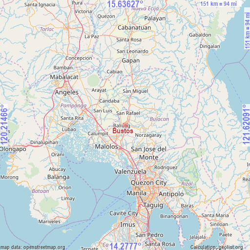
| Map corner | latitude | longitude |
|---|---|---|
| Upper-left | 15.63627°, | 120.21466° |
| Center: | 14.95806°, | 120.91778° |
| Lower-right: | 14.2777°, | 121.62091° |
| Map W x H: | 151.1×151.1 km | = 93.9×93.9mi |
| max Lat: | 20.78733° ⇑23% North |
| Bustos: | 14.95806° |
| min Lat: | ⇓77% South 4.65442° |
| min Long | Bustos | max Long |
| 117.04868° | 120.91778° | 126.58417° |
| W 21.2%⇐ | ⇒78.8% E |
Elevation
Elevation of Bustos is 13 m = 43 ft, and this is 74.9 m = 246 ft below average elevation for this country.
| Max E: |
2262 m = 7421 ft | 67.4% |
| Avg. | 87.9 m = 288 ft | |
| Bustos | 13 m = 43 ft | |
Min E: |
-2 m = -7 ft | 32.6% |
See also: Bustos elevation on elevation.city.
Geographical zone
Bustos is located in North Torrid zone (between Equator and Tropic of Cancer). Distance of this Northern Tropic circle is 942.7 km =585.8 mi to North.| Distance of | km | miles | from Bustos |
|---|---|---|---|
| North Pole | 8343.9 | 5184.7 | to North |
| Arctic Circle | 5738 | 3565.4 | to North |
| Tropic Cancer | 942.7 | 585.8 | to North |
| Equator | 1663.2 | 1033.5 | to South |


Nearby cities:
15 places around Bustos: (largest is in red/bold)
• Bagong Barrio
8 km =5 mi,  161°
161°
• Bahay Pare
9.2 km =5.7 mi,  334°
334°
• Baliuag
2.3 km =1.4 mi,  260°
260°
• Bulihan
9.4 km =5.8 mi,  194°
194°
• Culianin
5.2 km =3.2 mi,  203°
203°
• Diliman Primero
8.3 km =5.2 mi,  26°
26°
• Liciada
5 km =3.1 mi, 162°
• Maguinao
7.4 km =4.6 mi,  13°
13°
• Manatal
9 km =5.6 mi,  180°
180°
• Niugan
5.5 km =3.4 mi,  104°
104°
• Pantubig
4.1 km =2.5 mi,  74°
74°
• Pulilan
9.7 km =6 mi,  229°
229°
• San Rafael
4.9 km =3 mi, 102°
• San Roque
6.1 km =3.8 mi,  21°
21°
• Vizal Santo Niño
8 km =5 mi,  350°
350°
Sources, notices
• [Note1] Compared only with cities in Philippines existing in our database
• [Src1] Map data: © OpenStreetMap contributors (CC-BY-SA)
• [Src2] Other city data from geonames.org with taken over terms of usage.
• [Src3] Geographical zone / Annual Mean Temperature by Robert A. Rohde @ Wikipedia
