San Benito geodata
San Benito (Caraga) is a seat of a third-order administrative division; located in Philippines in Asia/Manila (GMT+8) time zone. With population of 2,334 people, there are 3601 cities with bigger population in this country. Compared to other cities in Philippines, 68.7% of cities are located further ↑North; 97.8% of cities are located further ←West and 76.6% of cities have higher elevation than San Benito. Note1
Administrative division(s):
- Level 1: Caraga
- Level 2: Province of Surigao del Norte
- Level 3: San Benito


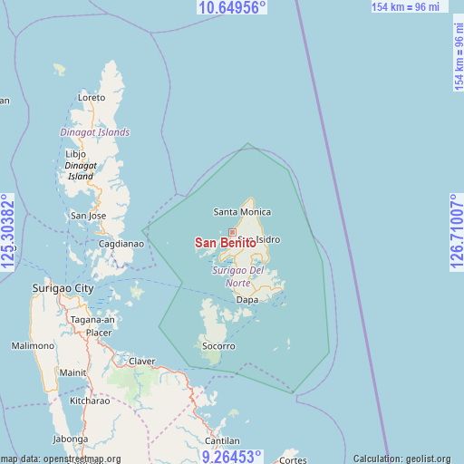
San Benito GPS coordinates[2]
9° 57' 28.008" North, 126° 0' 24.984" East
| Map corner | latitude | longitude |
|---|---|---|
| Upper-left | 10.64956°, | 125.30382° |
| Center: | 9.95778°, | 126.00694° |
| Lower-right: | 9.26453°, | 126.71007° |
| Map W x H: | 154×154 km | = 95.7×95.7mi |
| max Lat: | 20.78733° ⇑68.7% North |
| San Benito: | 9.95778° |
| min Lat: | ⇓31.3% South 4.65442° |
| min Long | San Benito | max Long |
| 117.04868° | 126.00694° | 126.58417° |
| W 97.8%⇐ | ⇒2.2% E |
Elevation
Elevation of San Benito is 10 m = 33 ft, and this is 77.9 m = 256 ft below average elevation for this country.
| Max E: |
2262 m = 7421 ft | 76.6% |
| Avg. | 87.9 m = 288 ft | |
| San Benito | 10 m = 33 ft | |
Min E: |
-2 m = -7 ft | 23.4% |
See also: Philippines elevation on elevation.city.
Geographical zone
San Benito is located in North Torrid zone (between Equator and Tropic of Cancer). Distance of Equator is 1107.2 km =688 mi to South.| Distance of | km | miles | from San Benito |
|---|---|---|---|
| North Pole | 8899.9 | 5530.1 | to North |
| Arctic Circle | 6294 | 3910.9 | to North |
| Tropic Cancer | 1498.7 | 931.2 | to North |
| Equator | 1107.2 | 688 | to South |


Nearby cities:
15 places around San Benito: (largest is in red/bold)
• Cagdianao
37.2 km =23.1 mi,  263°
263°
• Claver
52.3 km =32.5 mi,  215°
215°
• Dapa
22.6 km =14 mi,  167°
167°
• Del Carmen, Surigao del Norte
10.6 km =6.6 mi,  202°
202°
• Dinagat
45.3 km =28.1 mi,  269°
269°
• General Luna
25.5 km =15.8 mi,  139°
139°
• Gigaquit
52.7 km =32.7 mi, 220°
• Libas
8.7 km =5.4 mi, 197°
• Pilar
14.5 km =9 mi, 135°
• San Isidro
9.2 km =5.7 mi,  104°
104°
• San Jose
54 km =33.6 mi,  297°
297°
• Santa Monica
7.7 km =4.8 mi,  26°
26°
• Socorro
37.7 km =23.4 mi,  186°
186°
• Talisay
45.6 km =28.3 mi,  250°
250°
• Union
25.1 km =15.6 mi,  153°
153°
Sources, notices
• [Note1] Compared only with cities in Philippines existing in our database
• [Src1] Map data: © OpenStreetMap contributors (CC-BY-SA)
• [Src2] Other city data from geonames.org with taken over terms of usage.
• [Src3] Geographical zone / Annual Mean Temperature by Robert A. Rohde @ Wikipedia
