Pilar geodata
Pilar (Caraga) is a seat of a third-order administrative division; located in Philippines in Asia/Manila (GMT+8) time zone. With population of 2,392 people, there are 3477 cities with bigger population in this country. Compared to other cities in Philippines, 69.7% of cities are located further ↑North; 98.6% of cities are located further ←West and 92.7% of cities have higher elevation than Pilar. Note1


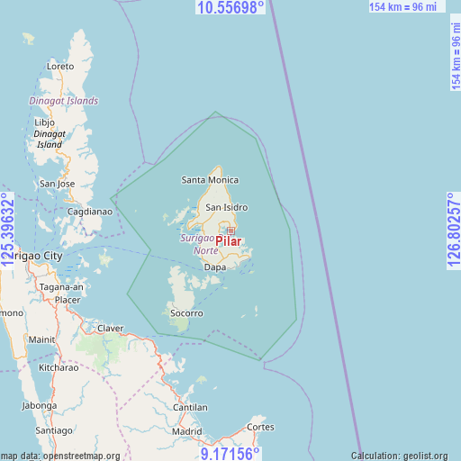
Pilar GPS coordinates[2]
9° 51' 54" North, 126° 5' 57.984" East
| Map corner | latitude | longitude |
|---|---|---|
| Upper-left | 10.55698°, | 125.39632° |
| Center: | 9.865°, | 126.09944° |
| Lower-right: | 9.17156°, | 126.80257° |
| Map W x H: | 154×154 km | = 95.7×95.7mi |
| max Lat: | 20.78733° ⇑69.7% North |
| Pilar: | 9.865° |
| min Lat: | ⇓30.3% South 4.65442° |
| min Long | Pilar | max Long |
| 117.04868° | 126.09944° | 126.58417° |
| W 98.6%⇐ | ⇒1.4% E |
Elevation
Elevation of Pilar is 6 m = 20 ft, and this is 81.9 m = 269 ft below average elevation for this country.
| Max E: |
2262 m = 7421 ft | 92.7% |
| Avg. | 87.9 m = 288 ft | |
| Pilar | 6 m = 20 ft | |
Min E: |
-2 m = -7 ft | 7.3% |
See also: Philippines elevation on elevation.city.
Geographical zone
Pilar is located in North Torrid zone (between Equator and Tropic of Cancer). Distance of Equator is 1096.9 km =681.6 mi to South.| Distance of | km | miles | from Pilar |
|---|---|---|---|
| North Pole | 8910.2 | 5536.5 | to North |
| Arctic Circle | 6304.3 | 3917.3 | to North |
| Tropic Cancer | 1509 | 937.6 | to North |
| Equator | 1096.9 | 681.6 | to South |


Nearby cities:
15 places around Pilar: (largest is in red/bold)
• Adlay
55.3 km =34.4 mi,  203°
203°
• Cagdianao
47.5 km =29.5 mi,  277°
277°
• Claver
51.7 km =32.1 mi,  230°
230°
• Dapa
12.8 km =8 mi, 203°
• Del Carmen, Surigao del Norte
14.2 km =8.8 mi,  271°
271°
• Dinagat
56.4 km =35 mi, 280°
• General Luna
11.1 km =6.9 mi,  144°
144°
• Gigaquit
53.3 km =33.1 mi,  235°
235°
• Libas
12.9 km =8 mi, 279°
• San Benito
14.5 km =9 mi,  315°
315°
• San Isidro
8.1 km =5 mi,  351°
351°
• Santa Monica
18.5 km =11.5 mi,  338°
338°
• Socorro
30.7 km =19.1 mi,  208°
208°
• Talisay
53.3 km =33.1 mi,  264°
264°
• Union
12.1 km =7.5 mi,  174°
174°
Sources, notices
• [Note1] Compared only with cities in Philippines existing in our database
• [Src1] Map data: © OpenStreetMap contributors (CC-BY-SA)
• [Src2] Other city data from geonames.org with taken over terms of usage.
• [Src3] Geographical zone / Annual Mean Temperature by Robert A. Rohde @ Wikipedia
