Libas geodata
Libas (Caraga) is a populated place; located in Philippines in Asia/Manila (GMT+8) time zone. With population of 3,373 people, there are 2166 cities with bigger population in this country. Compared to other cities in Philippines, 69.6% of cities are located further ↑North; 97.6% of cities are located further ←West and 62.8% of cities have higher elevation than Libas. Note1
Administrative division(s):
- Level 1: Caraga
- Level 2: Province of Surigao del Norte
- Level 3: Del Carmen


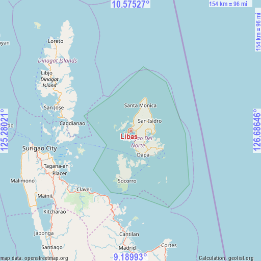
Libas GPS coordinates[2]
9° 52' 59.988" North, 125° 58' 59.988" East
| Map corner | latitude | longitude |
|---|---|---|
| Upper-left | 10.57527°, | 125.28021° |
| Center: | 9.88333°, | 125.98333° |
| Lower-right: | 9.18993°, | 126.68646° |
| Map W x H: | 154×154 km | = 95.7×95.7mi |
| max Lat: | 20.78733° ⇑69.6% North |
| Libas: | 9.88333° |
| min Lat: | ⇓30.4% South 4.65442° |
| min Long | Libas | max Long |
| 117.04868° | 125.98333° | 126.58417° |
| W 97.6%⇐ | ⇒2.4% E |
Elevation
Elevation of Libas is 15 m = 49 ft, and this is 72.9 m = 239 ft below average elevation for this country.
| Max E: |
2262 m = 7421 ft | 62.8% |
| Avg. | 87.9 m = 288 ft | |
| Libas | 15 m = 49 ft | |
Min E: |
-2 m = -7 ft | 37.2% |
See also: Philippines elevation on elevation.city.
Geographical zone
Libas is located in North Torrid zone (between Equator and Tropic of Cancer). Distance of Equator is 1098.9 km =682.8 mi to South.| Distance of | km | miles | from Libas |
|---|---|---|---|
| North Pole | 8908.1 | 5535.2 | to North |
| Arctic Circle | 6302.3 | 3916.1 | to North |
| Tropic Cancer | 1507 | 936.4 | to North |
| Equator | 1098.9 | 682.8 | to South |


Nearby cities:
15 places around Libas: (largest is in red/bold)
• Cagdianao
34.7 km =21.6 mi,  276°
276°
• Claver
44.1 km =27.4 mi,  218°
218°
• Dapa
15.8 km =9.8 mi,  150°
150°
• Del Carmen, Surigao del Norte
2.1 km =1.3 mi, 223°
• Dinagat
43.5 km =27 mi, 280°
• General Luna
22.2 km =13.8 mi,  119°
119°
• Gigaquit
44.9 km =27.9 mi, 224°
• Pilar
12.9 km =8 mi,  99°
99°
• San Benito
8.7 km =5.4 mi,  17°
17°
• San Isidro
13 km =8.1 mi,  62°
62°
• Santa Monica
16.3 km =10.1 mi, 21°
• Socorro
29.2 km =18.1 mi,  183°
183°
• Tagana-an
48.2 km =30 mi,  244°
244°
• Talisay
40.9 km =25.4 mi,  259°
259°
• Union
19.8 km =12.3 mi,  135°
135°
Sources, notices
• [Note1] Compared only with cities in Philippines existing in our database
• [Src1] Map data: © OpenStreetMap contributors (CC-BY-SA)
• [Src2] Other city data from geonames.org with taken over terms of usage.
• [Src3] Geographical zone / Annual Mean Temperature by Robert A. Rohde @ Wikipedia
