Panlaitan geodata
Panlaitan (Mimaropa) is a populated place; located in Philippines in Asia/Manila (GMT+8) time zone. With population of 2,596 people, there are 3115 cities with bigger population in this country. Compared to other cities in Philippines, 52.3% of cities are located further ↓South; 98.3% of cities are located further →East and 60.8% of cities have higher elevation than Panlaitan. Note1


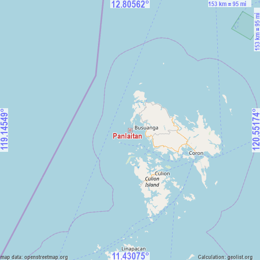
Panlaitan GPS coordinates[2]
12° 7' 8.652" North, 119° 50' 54.996" East
| Map corner | latitude | longitude |
|---|---|---|
| Upper-left | 12.80562°, | 119.14549° |
| Center: | 12.11907°, | 119.84861° |
| Lower-right: | 11.43075°, | 120.55174° |
| Map W x H: | 152.9×152.9 km | = 95×95mi |
| max Lat: | 20.78733° ⇑47.7% North |
| Panlaitan: | 12.11907° |
| min Lat: | ⇓52.3% South 4.65442° |
| min Long | Panlaitan | max Long |
| 117.04868° | 119.84861° | 126.58417° |
| W 1.7%⇐ | ⇒98.3% E |
Elevation
Elevation of Panlaitan is 16 m = 52 ft, and this is 71.9 m = 236 ft below average elevation for this country.
| Max E: |
2262 m = 7421 ft | 60.8% |
| Avg. | 87.9 m = 288 ft | |
| Panlaitan | 16 m = 52 ft | |
Min E: |
-2 m = -7 ft | 39.2% |
See also: Philippines elevation on elevation.city.
Geographical zone
Panlaitan is located in North Torrid zone (between Equator and Tropic of Cancer). Distance of this Northern Tropic circle is 1258.4 km =781.9 mi to North.| Distance of | km | miles | from Panlaitan |
|---|---|---|---|
| North Pole | 8659.5 | 5380.8 | to North |
| Arctic Circle | 6053.7 | 3761.6 | to North |
| Tropic Cancer | 1258.4 | 781.9 | to North |
| Equator | 1347.5 | 837.3 | to South |


Nearby cities:
15 places around Panlaitan: (largest is in red/bold)
• Adela
127.3 km =79.1 mi,  73°
73°
• Batasan
124.4 km =77.3 mi,  54°
54°
• Bulalacao
54.6 km =33.9 mi,  139°
139°
• Buluang
13 km =8.1 mi,  13°
13°
• Busuanga
8.7 km =5.4 mi,  59°
59°
• Calintaan
127.9 km =79.5 mi, 67°
• Casian
121.4 km =75.4 mi,  186°
186°
• Coron
40.9 km =25.4 mi,  109°
109°
• El Nido
114.9 km =71.4 mi,  205°
205°
• Ligaya
128.3 km =79.7 mi, 62°
• Rizal
127.5 km =79.2 mi, 72°
• Sablayan
127.7 km =79.3 mi, 51°
• Salvacion
9.3 km =5.8 mi,  80°
80°
• San Miguel
69.7 km =43.3 mi,  178°
178°
• Tiniguiban
92.6 km =57.5 mi,  203°
203°
Sources, notices
• [Note1] Compared only with cities in Philippines existing in our database
• [Src1] Map data: © OpenStreetMap contributors (CC-BY-SA)
• [Src2] Other city data from geonames.org with taken over terms of usage.
• [Src3] Geographical zone / Annual Mean Temperature by Robert A. Rohde @ Wikipedia
