Bulalacao geodata
Bulalacao (Mimaropa) is a populated place; located in Philippines in Asia/Manila (GMT+8) time zone. With population of 2,387 people, there are 3485 cities with bigger population in this country. Compared to other cities in Philippines, 50.6% of cities are located further ↓South; 96.2% of cities are located further →East and 92.7% of cities have higher elevation than Bulalacao. Note1


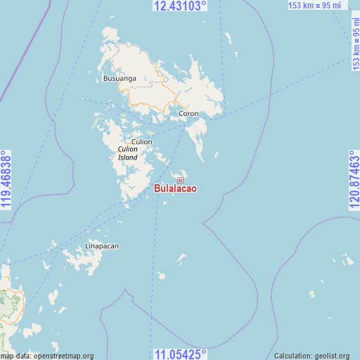
Bulalacao GPS coordinates[2]
11° 44' 36.6" North, 120° 10' 17.4" East
| Map corner | latitude | longitude |
|---|---|---|
| Upper-left | 12.43103°, | 119.46838° |
| Center: | 11.7435°, | 120.1715° |
| Lower-right: | 11.05425°, | 120.87463° |
| Map W x H: | 153.1×153.1 km | = 95.1×95.1mi |
| max Lat: | 20.78733° ⇑49.4% North |
| Bulalacao: | 11.7435° |
| min Lat: | ⇓50.6% South 4.65442° |
| min Long | Bulalacao | max Long |
| 117.04868° | 120.1715° | 126.58417° |
| W 3.8%⇐ | ⇒96.2% E |
Elevation
Elevation of Bulalacao is 6 m = 20 ft, and this is 81.9 m = 269 ft below average elevation for this country.
| Max E: |
2262 m = 7421 ft | 92.7% |
| Avg. | 87.9 m = 288 ft | |
| Bulalacao | 6 m = 20 ft | |
Min E: |
-2 m = -7 ft | 7.3% |
See also: Philippines elevation on elevation.city.
Geographical zone
Bulalacao is located in North Torrid zone (between Equator and Tropic of Cancer). Distance of this Northern Tropic circle is 1300.2 km =807.9 mi to North.| Distance of | km | miles | from Bulalacao |
|---|---|---|---|
| North Pole | 8701.3 | 5406.7 | to North |
| Arctic Circle | 6095.4 | 3787.5 | to North |
| Tropic Cancer | 1300.2 | 807.9 | to North |
| Equator | 1305.8 | 811.4 | to South |


Nearby cities:
15 places around Bulalacao: (largest is in red/bold)
• Adela
116.7 km =72.5 mi,  48°
48°
• Agutaya
106.9 km =66.4 mi,  128°
128°
• Algeciras
79.2 km =49.2 mi,  117°
117°
• Babug
117.7 km =73.1 mi, 53°
• Buluang
63.3 km =39.3 mi,  329°
329°
• Busuanga
53.8 km =33.4 mi, 329°
• Casian
93.3 km =58 mi,  212°
212°
• Coron
28.6 km =17.8 mi,  7°
7°
• El Nido
104.9 km =65.2 mi,  233°
233°
• Panlaitan
54.6 km =33.9 mi,  319°
319°
• Salvacion
50.5 km =31.4 mi, 329°
• San Agustin
116.5 km =72.4 mi, 49°
• San Miguel
43.1 km =26.8 mi, 229°
• Santa Teresa
116.9 km =72.6 mi,  61°
61°
• Tiniguiban
84.4 km =52.4 mi,  239°
239°
Sources, notices
• [Note1] Compared only with cities in Philippines existing in our database
• [Src1] Map data: © OpenStreetMap contributors (CC-BY-SA)
• [Src2] Other city data from geonames.org with taken over terms of usage.
• [Src3] Geographical zone / Annual Mean Temperature by Robert A. Rohde @ Wikipedia
