Bitangan geodata
Bitangan (Calabarzon) is a populated place; located in Philippines in Asia/Manila (GMT+8) time zone. With population of 3,284 people, there are 2228 cities with bigger population in this country. Compared to other cities in Philippines, 72.4% of cities are located further ↓South; 80.1% of cities are located further →East and 87.8% of cities have lower elevation than Bitangan. Note1
Administrative division(s):
- Level 1: Calabarzon
- Level 2: Province of Cavite
- Level 3: Trece Martires City


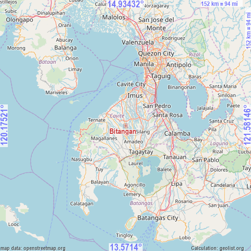
Bitangan GPS coordinates[2]
14° 15' 14.004" North, 120° 52' 41.988" East
| Map corner | latitude | longitude |
|---|---|---|
| Upper-left | 14.93432°, | 120.17521° |
| Center: | 14.25389°, | 120.87833° |
| Lower-right: | 13.5714°, | 121.58146° |
| Map W x H: | 151.5×151.5 km | = 94.1×94.1mi |
| max Lat: | 20.78733° ⇑27.6% North |
| Bitangan: | 14.25389° |
| min Lat: | ⇓72.4% South 4.65442° |
| min Long | Bitangan | max Long |
| 117.04868° | 120.87833° | 126.58417° |
| W 19.9%⇐ | ⇒80.1% E |
Elevation
Elevation of Bitangan is 178 m = 584 ft, and this is 90.1 m = 296 ft above average elevation for this country.
| Max E: |
2262 m = 7421 ft | 12.2% |
| Bitangan | 178 m 584 ft | |
| Avg. | 87.9 m = 288 ft | |
Min E: |
-2 m = -7 ft | 87.8% |
See also: Philippines elevation on elevation.city.
Geographical zone
Bitangan is located in North Torrid zone (between Equator and Tropic of Cancer). Distance of this Northern Tropic circle is 1021 km =634.4 mi to North.| Distance of | km | miles | from Bitangan |
|---|---|---|---|
| North Pole | 8422.2 | 5233.3 | to North |
| Arctic Circle | 5816.3 | 3614.1 | to North |
| Tropic Cancer | 1021 | 634.4 | to North |
| Equator | 1584.9 | 984.8 | to South |


Nearby cities:
15 places around Bitangan: (largest is in red/bold)
• Aliang
3.3 km =2.1 mi,  9°
9°
• Banaba
5.1 km =3.2 mi,  216°
216°
• Batas
8.9 km =5.5 mi,  227°
227°
• Biga
10.1 km =6.3 mi,  87°
87°
• Dasmariñas
10.5 km =6.5 mi,  36°
36°
• Indang
6.5 km =4 mi,  181°
181°
• Javalera
4 km =2.5 mi,  83°
83°
• Malainen Luma
9.9 km =6.2 mi,  280°
280°
• Manggahan
4.9 km =3 mi,  30°
30°
• Palangue
8 km =5 mi,  295°
295°
• Pangil
6.7 km =4.2 mi,  151°
151°
• Pantijan No 2
8.7 km =5.4 mi,  254°
254°
• Paradahan
7.7 km =4.8 mi,  345°
345°
• Pasong Kawayan Primero
9.9 km =6.2 mi,  2°
2°
• Sabang
9.9 km =6.2 mi,  305°
305°
Sources, notices
• [Note1] Compared only with cities in Philippines existing in our database
• [Src1] Map data: © OpenStreetMap contributors (CC-BY-SA)
• [Src2] Other city data from geonames.org with taken over terms of usage.
• [Src3] Geographical zone / Annual Mean Temperature by Robert A. Rohde @ Wikipedia
