Mansilingan geodata
Mansilingan (Western Visayas) is a populated place; located in Philippines in Asia/Manila (GMT+8) time zone. With population of 454,150 people, there are 15 cities with bigger population in this country. Compared to other cities in Philippines, 61.8% of cities are located further ↑North; 52.8% of cities are located further ←West and 66.7% of cities have lower elevation than Mansilingan. Note1
Administrative division(s):
- Level 1: Western Visayas
- Level 2: Province of Negros Occidental
- Level 3: Bacolod City


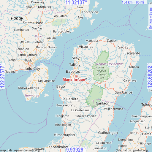
Mansilingan GPS coordinates[2]
10° 37' 51.996" North, 122° 58' 44.004" East
| Map corner | latitude | longitude |
|---|---|---|
| Upper-left | 11.32137°, | 122.27577° |
| Center: | 10.63111°, | 122.97889° |
| Lower-right: | 9.93929°, | 123.68202° |
| Map W x H: | 153.7×153.7 km | = 95.5×95.5mi |
| max Lat: | 20.78733° ⇑61.8% North |
| Mansilingan: | 10.63111° |
| min Lat: | ⇓38.2% South 4.65442° |
| min Long | Mansilingan | max Long |
| 117.04868° | 122.97889° | 126.58417° |
| W 52.8%⇐ | ⇒47.2% E |
Elevation
Elevation of Mansilingan is 45 m = 148 ft, and this is 42.9 m = 141 ft below average elevation for this country.
| Max E: |
2262 m = 7421 ft | 33.3% |
| Avg. | 87.9 m = 288 ft | |
| Mansilingan | 45 m = 148 ft | |
Min E: |
-2 m = -7 ft | 66.7% |
See also: Mansilingan elevation on elevation.city.
Geographical zone
Mansilingan is located in North Torrid zone (between Equator and Tropic of Cancer). Distance of Equator is 1182.1 km =734.5 mi to South.| Distance of | km | miles | from Mansilingan |
|---|---|---|---|
| North Pole | 8825 | 5483.6 | to North |
| Arctic Circle | 6219.1 | 3864.4 | to North |
| Tropic Cancer | 1423.9 | 884.8 | to North |
| Equator | 1182.1 | 734.5 | to South |


Nearby cities:
15 places around Mansilingan: (largest is in red/bold)
• Alegria
11.5 km =7.1 mi,  83°
83°
• Atipuluhan
13.2 km =8.2 mi,  187°
187°
• Bacolod City
5.1 km =3.2 mi,  321°
321°
• Buenavista
13.3 km =8.3 mi,  97°
97°
• Busay
14.5 km =9 mi,  224°
224°
• Cansilayan
9 km =5.6 mi,  151°
151°
• Concepcion
11.2 km =7 mi,  52°
52°
• Dos Hermanas
13.9 km =8.6 mi,  27°
27°
• Dulao
10.9 km =6.8 mi,  204°
204°
• Murcia
7.4 km =4.6 mi,  112°
112°
• San Fernando
13.2 km =8.2 mi, 48°
• Santa Cruz
11.3 km =7 mi,  88°
88°
• Sumag
7.3 km =4.5 mi,  243°
243°
• Talisay
11.9 km =7.4 mi,  353°
353°
• Taloc
11.1 km =6.9 mi, 235°
Sources, notices
• [Note1] Compared only with cities in Philippines existing in our database
• [Src1] Map data: © OpenStreetMap contributors (CC-BY-SA)
• [Src2] Other city data from geonames.org with taken over terms of usage.
• [Src3] Geographical zone / Annual Mean Temperature by Robert A. Rohde @ Wikipedia
