Bituñgol geodata
Bituñgol (Central Luzon) is a populated place; located in Philippines in Asia/Manila (GMT+8) time zone. With population of 4,746 people, there are 1395 cities with bigger population in this country. Compared to other cities in Philippines, 76.3% of cities are located further ↓South; 75.5% of cities are located further →East and 75.3% of cities have lower elevation than Bituñgol. Note1


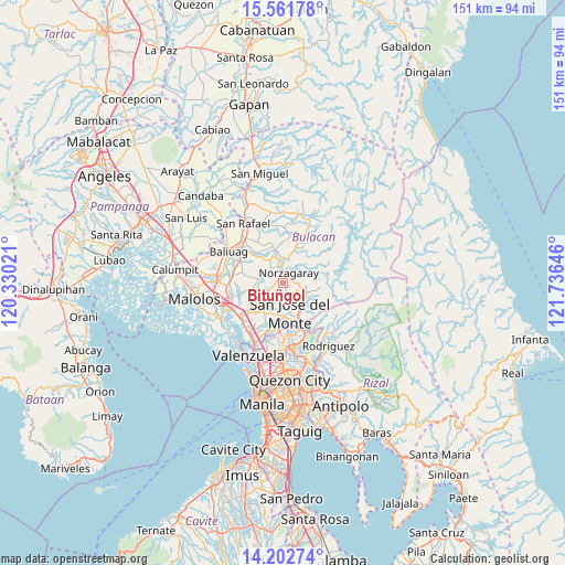
Bituñgol GPS coordinates[2]
14° 52' 59.988" North, 121° 1' 59.988" East
| Map corner | latitude | longitude |
|---|---|---|
| Upper-left | 15.56178°, | 120.33021° |
| Center: | 14.88333°, | 121.03333° |
| Lower-right: | 14.20274°, | 121.73646° |
| Map W x H: | 151.1×151.1 km | = 93.9×93.9mi |
| max Lat: | 20.78733° ⇑23.7% North |
| Bituñgol: | 14.88333° |
| min Lat: | ⇓76.3% South 4.65442° |
| min Long | Bituñgol | max Long |
| 117.04868° | 121.03333° | 126.58417° |
| W 24.5%⇐ | ⇒75.5% E |
Elevation
Elevation of Bituñgol is 69 m = 226 ft, and this is 18.9 m = 62 ft below average elevation for this country.
| Max E: |
2262 m = 7421 ft | 24.7% |
| Avg. | 87.9 m = 288 ft | |
| Bituñgol | 69 m = 226 ft | |
Min E: |
-2 m = -7 ft | 75.3% |
See also: Philippines elevation on elevation.city.
Geographical zone
Bituñgol is located in North Torrid zone (between Equator and Tropic of Cancer). Distance of this Northern Tropic circle is 951 km =590.9 mi to North.| Distance of | km | miles | from Bituñgol |
|---|---|---|---|
| North Pole | 8352.2 | 5189.8 | to North |
| Arctic Circle | 5746.3 | 3570.6 | to North |
| Tropic Cancer | 951 | 590.9 | to North |
| Equator | 1654.9 | 1028.3 | to South |


Nearby cities:
15 places around Bituñgol: (largest is in red/bold)
• Angat
5 km =3.1 mi,  355°
355°
• Bagong Barrio
10 km =6.2 mi,  274°
274°
• Balasing
3.9 km =2.4 mi,  214°
214°
• Guyong
7.9 km =4.9 mi,  228°
228°
• Liciada
11.5 km =7.1 mi,  287°
287°
• Loma de Gato
11.2 km =7 mi,  199°
199°
• Maasim
12.5 km =7.8 mi, 358°
• Niugan
10 km =6.2 mi,  314°
314°
• Norzagaray
3.5 km =2.2 mi,  29°
29°
• Pandi
8.4 km =5.2 mi,  256°
256°
• Pulo
9 km =5.6 mi,  347°
347°
• Pulong Sampalok
9.1 km =5.7 mi,  18°
18°
• San Jose del Monte
7.8 km =4.8 mi,  170°
170°
• San Rafael
10.5 km =6.5 mi, 313°
• Santa Maria
10.2 km =6.3 mi, 227°
Sources, notices
• [Note1] Compared only with cities in Philippines existing in our database
• [Src1] Map data: © OpenStreetMap contributors (CC-BY-SA)
• [Src2] Other city data from geonames.org with taken over terms of usage.
• [Src3] Geographical zone / Annual Mean Temperature by Robert A. Rohde @ Wikipedia
