Kimanuit geodata
Kimanuit (Northern Mindanao) is a populated place; located in Philippines in Asia/Manila (GMT+8) time zone. With population of 3,590 people, there are 1989 cities with bigger population in this country. Compared to other cities in Philippines, 84.6% of cities are located further ↑North; 82.8% of cities are located further ←West and 96.2% of cities have lower elevation than Kimanuit. Note1
Administrative division(s):
- Level 1: Northern Mindanao
- Level 2: Province of Bukidnon
- Level 3: Kalilangan


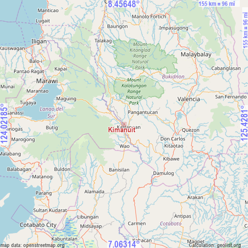
Kimanuit GPS coordinates[2]
7° 45' 37.404" North, 124° 43' 29.892" East
| Map corner | latitude | longitude |
|---|---|---|
| Upper-left | 8.45648°, | 124.02185° |
| Center: | 7.76039°, | 124.72497° |
| Lower-right: | 7.06314°, | 125.4281° |
| Map W x H: | 154.9×154.9 km | = 96.3×96.3mi |
| max Lat: | 20.78733° ⇑84.6% North |
| Kimanuit: | 7.76039° |
| min Lat: | ⇓15.4% South 4.65442° |
| min Long | Kimanuit | max Long |
| 117.04868° | 124.72497° | 126.58417° |
| W 82.8%⇐ | ⇒17.2% E |
Elevation
Elevation of Kimanuit is 521 m = 1709 ft, and this is 433.1 m = 1421 ft above average elevation for this country.
| Max E: |
2262 m = 7421 ft | 3.8% |
| Kimanuit | 521 m 1709 ft | |
| Avg. | 87.9 m = 288 ft | |
Min E: |
-2 m = -7 ft | 96.2% |
See also: Philippines elevation on elevation.city.
Geographical zone
Kimanuit is located in North Torrid zone (between Equator and Tropic of Cancer). Distance of Equator is 862.9 km =536.2 mi to South.| Distance of | km | miles | from Kimanuit |
|---|---|---|---|
| North Pole | 9144.2 | 5681.9 | to North |
| Arctic Circle | 6538.3 | 4062.7 | to North |
| Tropic Cancer | 1743 | 1083 | to North |
| Equator | 862.9 | 536.2 | to South |


Nearby cities:
15 places around Kimanuit: (largest is in red/bold)
• Adtugan
15.4 km =9.6 mi,  68°
68°
• Bangahan
4.1 km =2.5 mi,  13°
13°
• Banisilan
30 km =18.6 mi,  180°
180°
• Bumbaran
9.4 km =5.8 mi,  298°
298°
• Don Carlos
32.1 km =19.9 mi,  106°
106°
• Kadingilan
26.9 km =16.7 mi,  131°
131°
• Kalilangan
3 km =1.9 mi,  124°
124°
• La Roxas
21.2 km =13.2 mi,  57°
57°
• Malinao
22.3 km =13.9 mi, 184°
• Maramag
30.9 km =19.2 mi,  89°
89°
• Osias
20.5 km =12.7 mi,  150°
150°
• Pangantocan
13.6 km =8.5 mi,  44°
44°
• San Miguel
30.1 km =18.7 mi, 6°
• Ticala-an
32.6 km =20.3 mi,  339°
339°
• Wao
10.7 km =6.6 mi,  216°
216°
Sources, notices
• [Note1] Compared only with cities in Philippines existing in our database
• [Src1] Map data: © OpenStreetMap contributors (CC-BY-SA)
• [Src2] Other city data from geonames.org with taken over terms of usage.
• [Src3] Geographical zone / Annual Mean Temperature by Robert A. Rohde @ Wikipedia
