Esmeralda geodata
Esmeralda (Ilocos) is a populated place; located in Philippines in Asia/Manila (GMT+8) time zone. With population of 2,674 people, there are 2994 cities with bigger population in this country. Compared to other cities in Philippines, 85.7% of cities are located further ↓South; 84.6% of cities are located further →East and 71.2% of cities have lower elevation than Esmeralda. Note1


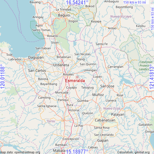
Esmeralda GPS coordinates[2]
15° 52' 1.992" North, 120° 42' 54" East
| Map corner | latitude | longitude |
|---|---|---|
| Upper-left | 16.54241°, | 120.01188° |
| Center: | 15.86722°, | 120.715° |
| Lower-right: | 15.18977°, | 121.41813° |
| Map W x H: | 150.4×150.4 km | = 93.5×93.5mi |
| max Lat: | 20.78733° ⇑14.3% North |
| Esmeralda: | 15.86722° |
| min Lat: | ⇓85.7% South 4.65442° |
| min Long | Esmeralda | max Long |
| 117.04868° | 120.715° | 126.58417° |
| W 15.4%⇐ | ⇒84.6% E |
Elevation
Elevation of Esmeralda is 55 m = 180 ft, and this is 32.9 m = 108 ft below average elevation for this country.
| Max E: |
2262 m = 7421 ft | 28.8% |
| Avg. | 87.9 m = 288 ft | |
| Esmeralda | 55 m = 180 ft | |
Min E: |
-2 m = -7 ft | 71.2% |
See also: Philippines elevation on elevation.city.
Geographical zone
Esmeralda is located in North Torrid zone (between Equator and Tropic of Cancer). Distance of this Northern Tropic circle is 841.6 km =522.9 mi to North.| Distance of | km | miles | from Esmeralda |
|---|---|---|---|
| North Pole | 8242.8 | 5121.8 | to North |
| Arctic Circle | 5636.9 | 3502.6 | to North |
| Tropic Cancer | 841.6 | 522.9 | to North |
| Equator | 1764.3 | 1096.3 | to South |


Nearby cities:
15 places around Esmeralda: (largest is in red/bold)
• Baloy
9.4 km =5.8 mi,  137°
137°
• Balungao
4.5 km =2.8 mi,  320°
320°
• Bued
7.7 km =4.8 mi,  243°
243°
• Calancuasan Norte
10.8 km =6.7 mi,  227°
227°
• Capandanan
10.5 km =6.5 mi,  348°
348°
• Caramutan
12.7 km =7.9 mi,  297°
297°
• Carmen
12.5 km =7.8 mi,  279°
279°
• Cuyapo
10.9 km =6.8 mi,  209°
209°
• Gueset
12.7 km =7.9 mi, 316°
• Guiling
11 km =6.8 mi,  255°
255°
• Paitan Norte
4.7 km =2.9 mi, 143°
• Rosales
9.3 km =5.8 mi,  288°
288°
• Salcedo
12.4 km =7.7 mi, 264°
• Samon
10.2 km =6.3 mi, 317°
• Umingan
9.6 km =6 mi,  67°
67°
Sources, notices
• [Note1] Compared only with cities in Philippines existing in our database
• [Src1] Map data: © OpenStreetMap contributors (CC-BY-SA)
• [Src2] Other city data from geonames.org with taken over terms of usage.
• [Src3] Geographical zone / Annual Mean Temperature by Robert A. Rohde @ Wikipedia
