Castillejos geodata
Castillejos (Central Luzon) is a seat of a third-order administrative division; located in Philippines in Asia/Manila (GMT+8) time zone. With population of 27,301 people, there are 299 cities with bigger population in this country. Compared to other cities in Philippines, 76.8% of cities are located further ↓South; 96.1% of cities are located further →East and 68.9% of cities have lower elevation than Castillejos. Note1
Administrative division(s):
- Level 1: Central Luzon
- Level 2: Province of Zambales
- Level 3: Castillejos


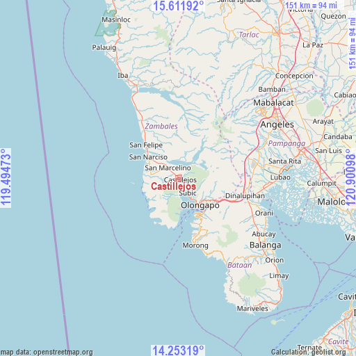
Castillejos GPS coordinates[2]
14° 56' 1.068" North, 120° 11' 52.26" East
| Map corner | latitude | longitude |
|---|---|---|
| Upper-left | 15.61192°, | 119.49473° |
| Center: | 14.93363°, | 120.19785° |
| Lower-right: | 14.25319°, | 120.90098° |
| Map W x H: | 151.1×151.1 km | = 93.9×93.9mi |
| max Lat: | 20.78733° ⇑23.2% North |
| Castillejos: | 14.93363° |
| min Lat: | ⇓76.8% South 4.65442° |
| min Long | Castillejos | max Long |
| 117.04868° | 120.19785° | 126.58417° |
| W 3.9%⇐ | ⇒96.1% E |
Elevation
Elevation of Castillejos is 50 m = 164 ft, and this is 37.9 m = 124 ft below average elevation for this country.
| Max E: |
2262 m = 7421 ft | 31.1% |
| Avg. | 87.9 m = 288 ft | |
| Castillejos | 50 m = 164 ft | |
Min E: |
-2 m = -7 ft | 68.9% |
See also: Philippines elevation on elevation.city.
Geographical zone
Castillejos is located in North Torrid zone (between Equator and Tropic of Cancer). Distance of this Northern Tropic circle is 945.5 km =587.5 mi to North.| Distance of | km | miles | from Castillejos |
|---|---|---|---|
| North Pole | 8346.6 | 5186.3 | to North |
| Arctic Circle | 5740.7 | 3567.1 | to North |
| Tropic Cancer | 945.5 | 587.5 | to North |
| Equator | 1660.5 | 1031.8 | to South |


Nearby cities:
15 places around Castillejos: (largest is in red/bold)
• Beddeng
13.1 km =8.1 mi,  291°
291°
• Mabayo
24 km =14.9 mi,  158°
158°
• Maloma
24.6 km =15.3 mi,  324°
324°
• Olongapo
14.8 km =9.2 mi,  141°
141°
• Pamatawan
1.8 km =1.1 mi,  110°
110°
• Poblacion, San Felipe
19.8 km =12.3 mi, 316°
• San Agustin
5.1 km =3.2 mi,  269°
269°
• San Antonio
12 km =7.5 mi,  276°
276°
• San Benito
26.3 km =16.3 mi, 110°
• San Marcelino
6.3 km =3.9 mi, 316°
• San Narciso
15.5 km =9.6 mi,  305°
305°
• San Nicolas
13.1 km =8.1 mi, 277°
• Santa Fe
8.6 km =5.3 mi,  8°
8°
• Subic
7.1 km =4.4 mi,  149°
149°
• Subic Bay Freeport Zone
18.3 km =11.4 mi, 151°
Sources, notices
• [Note1] Compared only with cities in Philippines existing in our database
• [Src1] Map data: © OpenStreetMap contributors (CC-BY-SA)
• [Src2] Other city data from geonames.org with taken over terms of usage.
• [Src3] Geographical zone / Annual Mean Temperature by Robert A. Rohde @ Wikipedia
