Olongapo geodata
Olongapo (Central Luzon) is a seat of a third-order administrative division; located in Philippines in Asia/Manila (GMT+8) time zone. With population of 221,178 people, there are 46 cities with bigger population in this country. Compared to other cities in Philippines, 75.8% of cities are located further ↓South; 95.5% of cities are located further →East and 73.2% of cities have higher elevation than Olongapo. Note1
Administrative division(s):
- Level 1: Central Luzon
- Level 2: Province of Zambales
- Level 3: Olongapo City


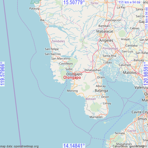
Olongapo GPS coordinates[2]
14° 49' 45.012" North, 120° 16' 58.008" East
| Map corner | latitude | longitude |
|---|---|---|
| Upper-left | 15.50779°, | 119.57966° |
| Center: | 14.82917°, | 120.28278° |
| Lower-right: | 14.14841°, | 120.98591° |
| Map W x H: | 151.1×151.2 km | = 93.9×94mi |
| max Lat: | 20.78733° ⇑24.2% North |
| Olongapo: | 14.82917° |
| min Lat: | ⇓75.8% South 4.65442° |
| min Long | Olongapo | max Long |
| 117.04868° | 120.28278° | 126.58417° |
| W 4.5%⇐ | ⇒95.5% E |
Elevation
Elevation of Olongapo is 11 m = 36 ft, and this is 76.9 m = 252 ft below average elevation for this country.
| Max E: |
2262 m = 7421 ft | 73.2% |
| Avg. | 87.9 m = 288 ft | |
| Olongapo | 11 m = 36 ft | |
Min E: |
-2 m = -7 ft | 26.8% |
See also: Olongapo elevation on elevation.city.
Geographical zone
Olongapo is located in North Torrid zone (between Equator and Tropic of Cancer). Distance of this Northern Tropic circle is 957.1 km =594.7 mi to North.| Distance of | km | miles | from Olongapo |
|---|---|---|---|
| North Pole | 8358.2 | 5193.5 | to North |
| Arctic Circle | 5752.3 | 3574.3 | to North |
| Tropic Cancer | 957.1 | 594.7 | to North |
| Equator | 1648.8 | 1024.5 | to South |


Nearby cities:
15 places around Olongapo: (largest is in red/bold)
• Balsic
21.7 km =13.5 mi,  81°
81°
• Bodega
23.6 km =14.7 mi,  63°
63°
• Castillejos
14.8 km =9.2 mi,  321°
321°
• Dinalupihan
19 km =11.8 mi,  73°
73°
• Hermosa
24.2 km =15 mi,  89°
89°
• Mabayo
10.8 km =6.7 mi,  182°
182°
• Morong
16.8 km =10.4 mi,  186°
186°
• Pamatawan
13.2 km =8.2 mi,  325°
325°
• Sabang
15.3 km =9.5 mi, 193°
• San Agustin
18.4 km =11.4 mi,  309°
309°
• San Benito
15.7 km =9.8 mi, 80°
• San Marcelino
21 km =13 mi, 320°
• Santa Fe
21.6 km =13.4 mi,  338°
338°
• Subic
7.8 km =4.8 mi, 315°
• Subic Bay Freeport Zone
4.5 km =2.8 mi, 184°
Sources, notices
• [Note1] Compared only with cities in Philippines existing in our database
• [Src1] Map data: © OpenStreetMap contributors (CC-BY-SA)
• [Src2] Other city data from geonames.org with taken over terms of usage.
• [Src3] Geographical zone / Annual Mean Temperature by Robert A. Rohde @ Wikipedia
