Concepcion geodata
Concepcion (Davao) is a populated place; located in Philippines in Asia/Manila (GMT+8) time zone. With population of 2,863 people, there are 2688 cities with bigger population in this country. Compared to other cities in Philippines, 84.7% of cities are located further ↑North; 95.9% of cities are located further ←West and 85.6% of cities have lower elevation than Concepcion. Note1


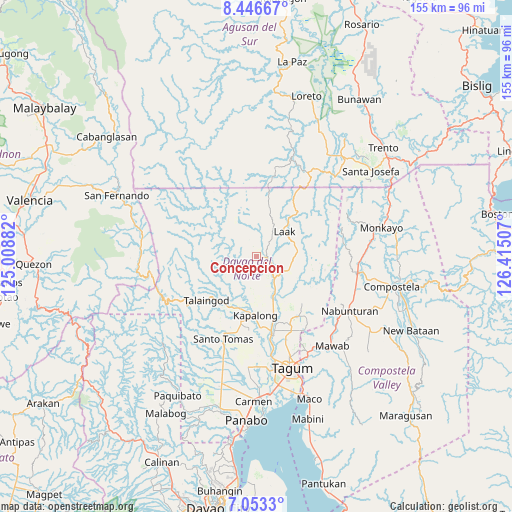
Concepcion GPS coordinates[2]
7° 45' 2.016" North, 125° 42' 42.984" East
| Map corner | latitude | longitude |
|---|---|---|
| Upper-left | 8.44667°, | 125.00882° |
| Center: | 7.75056°, | 125.71194° |
| Lower-right: | 7.0533°, | 126.41507° |
| Map W x H: | 154.9×154.9 km | = 96.3×96.3mi |
| max Lat: | 20.78733° ⇑84.7% North |
| Concepcion: | 7.75056° |
| min Lat: | ⇓15.3% South 4.65442° |
| min Long | Concepcion | max Long |
| 117.04868° | 125.71194° | 126.58417° |
| W 95.9%⇐ | ⇒4.1% E |
Elevation
Elevation of Concepcion is 146 m = 479 ft, and this is 58.1 m = 191 ft above average elevation for this country.
| Max E: |
2262 m = 7421 ft | 14.4% |
| Concepcion | 146 m 479 ft | |
| Avg. | 87.9 m = 288 ft | |
Min E: |
-2 m = -7 ft | 85.6% |
See also: Philippines elevation on elevation.city.
Geographical zone
Concepcion is located in North Torrid zone (between Equator and Tropic of Cancer). Distance of Equator is 861.8 km =535.5 mi to South.| Distance of | km | miles | from Concepcion |
|---|---|---|---|
| North Pole | 9145.3 | 5682.6 | to North |
| Arctic Circle | 6539.4 | 4063.4 | to North |
| Tropic Cancer | 1744.1 | 1083.7 | to North |
| Equator | 861.8 | 535.5 | to South |


Nearby cities:
15 places around Concepcion: (largest is in red/bold)
• Andop
13.1 km =8.1 mi,  20°
20°
• Gabuyan
16.5 km =10.3 mi,  196°
196°
• Gupitan
8.4 km =5.2 mi,  289°
289°
• Kaligutan
12.3 km =7.6 mi,  115°
115°
• Kapalong
17 km =10.6 mi,  277°
277°
• Limbaan
17.2 km =10.7 mi,  135°
135°
• Luna
20 km =12.4 mi,  194°
194°
• Magatos
21.7 km =13.5 mi,  175°
175°
• New Corella
22 km =13.7 mi,  145°
145°
• Pag-asa
19.7 km =12.2 mi, 189°
• Palma Gil
15.1 km =9.4 mi,  217°
217°
• Sampao
18.3 km =11.4 mi, 197°
• San Vicente
14.8 km =9.2 mi,  51°
51°
• Santo Niño
17 km =10.6 mi,  214°
214°
• Suz-on
12.7 km =7.9 mi, 219°
Sources, notices
• [Note1] Compared only with cities in Philippines existing in our database
• [Src1] Map data: © OpenStreetMap contributors (CC-BY-SA)
• [Src2] Other city data from geonames.org with taken over terms of usage.
• [Src3] Geographical zone / Annual Mean Temperature by Robert A. Rohde @ Wikipedia
