Andop geodata
Andop (Davao) is a populated place; located in Philippines in Asia/Manila (GMT+8) time zone. With population of 9,095 people, there are 677 cities with bigger population in this country. Compared to other cities in Philippines, 83.7% of cities are located further ↑North; 96.3% of cities are located further ←West and 84.9% of cities have lower elevation than Andop. Note1


Andop GPS coordinates[2]
7° 51' 39.996" North, 125° 45' 14.004" East
| Map corner | latitude | longitude |
|---|---|---|
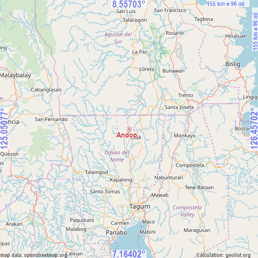
| Upper-left | 8.55703°, | 125.05077° |
| Center: | 7.86111°, | 125.75389° |
| Lower-right: | 7.16402°, | 126.45702° |
| Map W x H: | 154.9×154.9 km | = 96.3×96.3mi |
| max Lat: | 20.78733° ⇑83.7% North |
| Andop: | 7.86111° |
| min Lat: | ⇓16.3% South 4.65442° |
| min Long | Andop | max Long |
| 117.04868° | 125.75389° | 126.58417° |
| W 96.3%⇐ | ⇒3.7% E |
Elevation
Elevation of Andop is 136 m = 446 ft, and this is 48.1 m = 158 ft above average elevation for this country.
| Max E: |
2262 m = 7421 ft | 15.1% |
| Andop | 136 m 446 ft | |
| Avg. | 87.9 m = 288 ft | |
Min E: |
-2 m = -7 ft | 84.9% |
See also: Philippines elevation on elevation.city.
Geographical zone
Andop is located in North Torrid zone (between Equator and Tropic of Cancer). Distance of Equator is 874.1 km =543.1 mi to South.| Distance of | km | miles | from Andop |
|---|---|---|---|
| North Pole | 9133 | 5675 | to North |
| Arctic Circle | 6527.1 | 4055.8 | to North |
| Tropic Cancer | 1731.8 | 1076.1 | to North |
| Equator | 874.1 | 543.1 | to South |


Nearby cities:
15 places around Andop: (largest is in red/bold)
• Concepcion
13.1 km =8.1 mi,  200°
200°
• Gabuyan
29.7 km =18.5 mi, 198°
• Gupitan
15.7 km =9.8 mi,  232°
232°
• Kaligutan
18.7 km =11.6 mi,  159°
159°
• Kapalong
23.8 km =14.8 mi,  244°
244°
• Limbaan
25.7 km =16 mi, 163°
• Montevista
31.9 km =19.8 mi,  125°
125°
• New Corella
31.5 km =19.6 mi,  165°
165°
• Palma Gil
27.9 km =17.3 mi,  209°
209°
• Sampao
31.4 km =19.5 mi, 198°
• San Vicente
7.6 km =4.7 mi,  114°
114°
• Santo Niño
30 km =18.6 mi, 208°
• Sinubong
30.2 km =18.8 mi,  40°
40°
• Suz-on
25.5 km =15.8 mi, 209°
• Tapia
30.8 km =19.1 mi, 112°
Sources, notices
• [Note1] Compared only with cities in Philippines existing in our database
• [Src1] Map data: © OpenStreetMap contributors (CC-BY-SA)
• [Src2] Other city data from geonames.org with taken over terms of usage.
• [Src3] Geographical zone / Annual Mean Temperature by Robert A. Rohde @ Wikipedia
