Sohbatpur geodata
Sohbatpur (Balochistan) is a populated place; located in Pakistan in Asia/Karachi (GMT+5) time zone. With population of 8,940 people, there are 360 cities with bigger population in this country. Compared to other cities in Pakistan, 68.8% of cities are located further ↑North; 77.2% of cities are located further →East and 76.7% of cities have higher elevation than Sohbatpur. Note1


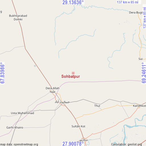
Sohbatpur GPS coordinates[2]
28° 31' 13.368" North, 68° 32' 34.728" East
| Map corner | latitude | longitude |
|---|---|---|
| Upper-left | 29.13636°, | 67.83986° |
| Center: | 28.52038°, | 68.54298° |
| Lower-right: | 27.90078°, | 69.24611° |
| Map W x H: | 137.4×137.4 km | = 85.4×85.4mi |
| max Lat: | 36.32162° ⇑68.8% North |
| Sohbatpur: | 28.52038° |
| min Lat: | ⇓31.2% South 24.14422° |
| min Long | Sohbatpur | max Long |
| 61.74573° | 68.54298° | 75.63372° |
| W 22.8%⇐ | ⇒77.2% E |
Elevation
Elevation of Sohbatpur is 59 m = 194 ft, and this is 286 m = 938 ft below average elevation for this country.
| Max E: |
2732 m = 8963 ft | 76.7% |
| Avg. | 345 m = 1132 ft | |
| Sohbatpur | 59 m = 194 ft | |
Min E: |
3 m = 10 ft | 23.3% |
See also: Pakistan elevation on elevation.city.
Geographical zone
Sohbatpur is located in North temperate zone (between Tropic of Cancer and the Arctic Circle). Distance of this Northern Tropic circle is 565.3 km =351.3 mi to South.| Distance of | km | miles | from Sohbatpur |
|---|---|---|---|
| North Pole | 6835.9 | 4247.6 | to North |
| Arctic Circle | 4230 | 2628.4 | to North |
| Tropic Cancer | 565.3 | 351.3 | to South |
| Equator | 3171.2 | 1970.5 | to South |


Nearby cities:
15 places around Sohbatpur: (largest is in red/bold)
• Chak
78.9 km =49 mi,  158°
158°
• Dera Allahyar
24.9 km =15.5 mi,  229°
229°
• Dera Murad Jamali
31.4 km =19.5 mi,  275°
275°
• Garhi Khairo
75.2 km =46.7 mi, 227°
• Garhiyasin
68.3 km =42.4 mi,  182°
182°
• Ghauspur
67.7 km =42.1 mi,  128°
128°
• Jacobabad
28.5 km =17.7 mi,  201°
201°
• Kandhkot
69.4 km =43.1 mi,  116°
116°
• Lakhi
76.2 km =47.3 mi,  168°
168°
• Mehrabpur
68.3 km =42.4 mi, 227°
• Rustam
66.6 km =41.4 mi, 157°
• Shikarpur
63.5 km =39.5 mi, 171°
• Tangwani
51.9 km =32.2 mi, 121°
• Thul
38.6 km =24 mi,  143°
143°
• Usta Muhammad
62 km =38.5 mi, 232°
Sources, notices
• [Note1] Compared only with cities in Pakistan existing in our database
• [Src1] Map data: © OpenStreetMap contributors (CC-BY-SA)
• [Src2] Other city data from geonames.org with taken over terms of usage.
• [Src3] Geographical zone / Annual Mean Temperature by Robert A. Rohde @ Wikipedia
