Jacobabad geodata
Jacobabad (Sindh) is a seat of a second-order administrative division; located in Pakistan in Asia/Karachi (GMT+5) time zone. With population of 170,588 people, there are 37 cities with bigger population in this country. Compared to other cities in Pakistan, 70.2% of cities are located further ↑North; 79.7% of cities are located further →East and 76.3% of cities have higher elevation than Jacobabad. Note1


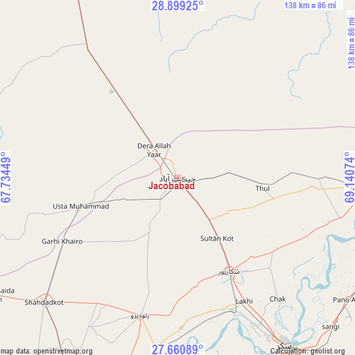
Jacobabad GPS coordinates[2]
28° 16' 54.732" North, 68° 26' 15.396" East
| Map corner | latitude | longitude |
|---|---|---|
| Upper-left | 28.89925°, | 67.73449° |
| Center: | 28.28187°, | 68.43761° |
| Lower-right: | 27.66089°, | 69.14074° |
| Map W x H: | 137.7×137.7 km | = 85.6×85.6mi |
| max Lat: | 36.32162° ⇑70.2% North |
| Jacobabad: | 28.28187° |
| min Lat: | ⇓29.8% South 24.14422° |
| min Long | Jacobabad | max Long |
| 61.74573° | 68.43761° | 75.63372° |
| W 20.3%⇐ | ⇒79.7% E |
Elevation
Elevation of Jacobabad is 60 m = 197 ft, and this is 285 m = 935 ft below average elevation for this country.
| Max E: |
2732 m = 8963 ft | 76.3% |
| Avg. | 345 m = 1132 ft | |
| Jacobabad | 60 m = 197 ft | |
Min E: |
3 m = 10 ft | 23.7% |
See also: Jacobabad elevation on elevation.city.
Geographical zone
Jacobabad is located in North temperate zone (between Tropic of Cancer and the Arctic Circle). Distance of this Northern Tropic circle is 538.7 km =334.7 mi to South.| Distance of | km | miles | from Jacobabad |
|---|---|---|---|
| North Pole | 6862.4 | 4264.1 | to North |
| Arctic Circle | 4256.5 | 2644.9 | to North |
| Tropic Cancer | 538.7 | 334.7 | to South |
| Equator | 3144.6 | 1954 | to South |


Nearby cities:
15 places around Jacobabad: (largest is in red/bold)
• Chowki Jamali
58.5 km =36.4 mi,  240°
240°
• Dera Allahyar
13.3 km =8.3 mi,  320°
320°
• Dera Murad Jamali
36.1 km =22.4 mi, 324°
• Garhi Khairo
51.1 km =31.8 mi, 241°
• Garhiyasin
42.4 km =26.3 mi,  170°
170°
• Lakhi
54.6 km =33.9 mi,  151°
151°
• Madeji
58.8 km =36.5 mi,  178°
178°
• Mehrabpur
44.8 km =27.8 mi, 244°
• Ratodero
55.3 km =34.4 mi,  195°
195°
• Rustam
50.2 km =31.2 mi,  134°
134°
• Shikarpur
41.3 km =25.7 mi, 151°
• Sohbatpur
28.5 km =17.7 mi,  21°
21°
• Tangwani
54.8 km =34.1 mi,  90°
90°
• Thul
33.4 km =20.8 mi,  97°
97°
• Usta Muhammad
40.3 km =25 mi,  253°
253°
Sources, notices
• [Note1] Compared only with cities in Pakistan existing in our database
• [Src1] Map data: © OpenStreetMap contributors (CC-BY-SA)
• [Src2] Other city data from geonames.org with taken over terms of usage.
• [Src3] Geographical zone / Annual Mean Temperature by Robert A. Rohde @ Wikipedia
