Ranipur geodata
Ranipur (Sindh) is a populated place; located in Pakistan in Asia/Karachi (GMT+5) time zone. With population of 22,495 people, there are 256 cities with bigger population in this country. Compared to other cities in Pakistan, 79.7% of cities are located further ↑North; 78.6% of cities are located further →East and 79.7% of cities have higher elevation than Ranipur. Note1


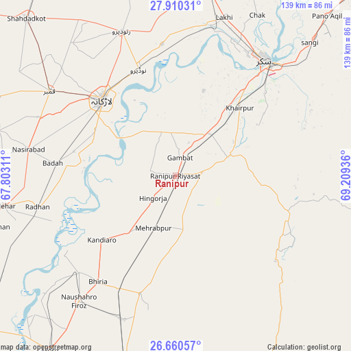
Ranipur GPS coordinates[2]
27° 17' 13.92" North, 68° 30' 22.428" East
| Map corner | latitude | longitude |
|---|---|---|
| Upper-left | 27.91031°, | 67.80311° |
| Center: | 27.2872°, | 68.50623° |
| Lower-right: | 26.66057°, | 69.20936° |
| Map W x H: | 139×139 km | = 86.4×86.4mi |
| max Lat: | 36.32162° ⇑79.7% North |
| Ranipur: | 27.2872° |
| min Lat: | ⇓20.3% South 24.14422° |
| min Long | Ranipur | max Long |
| 61.74573° | 68.50623° | 75.63372° |
| W 21.4%⇐ | ⇒78.6% E |
Elevation
Elevation of Ranipur is 54 m = 177 ft, and this is 291 m = 955 ft below average elevation for this country.
| Max E: |
2732 m = 8963 ft | 79.7% |
| Avg. | 345 m = 1132 ft | |
| Ranipur | 54 m = 177 ft | |
Min E: |
3 m = 10 ft | 20.3% |
See also: Pakistan elevation on elevation.city.
Geographical zone
Ranipur is located in North temperate zone (between Tropic of Cancer and the Arctic Circle). Distance of this Northern Tropic circle is 428.1 km =266 mi to South.| Distance of | km | miles | from Ranipur |
|---|---|---|---|
| North Pole | 6973 | 4332.8 | to North |
| Arctic Circle | 4367.1 | 2713.6 | to North |
| Tropic Cancer | 428.1 | 266 | to South |
| Equator | 3034.1 | 1885.3 | to South |


Nearby cities:
15 places around Ranipur: (largest is in red/bold)
• Bozdar Wada
17.3 km =10.7 mi,  132°
132°
• Dokri
41.5 km =25.8 mi,  283°
283°
• Gambat
7.3 km =4.5 mi,  11°
11°
• Goth Garelo
45.6 km =28.3 mi,  291°
291°
• Hingorja
12.3 km =7.6 mi,  226°
226°
• Kandiari
41.4 km =25.7 mi,  177°
177°
• Kandiaro
38.7 km =24 mi, 229°
• Karaundi
44.5 km =27.7 mi,  192°
192°
• Khairpur Mir’s
36.7 km =22.8 mi,  42°
42°
• Kot Diji
20.8 km =12.9 mi,  73°
73°
• Larkana
41.9 km =26 mi,  316°
316°
• Naudero
44.6 km =27.7 mi,  341°
341°
• Pir Jo Goth
35.6 km =22.1 mi,  18°
18°
• Setharja Old
9.1 km =5.7 mi,  204°
204°
• Sobhodero
11 km =6.8 mi, 280°
Sources, notices
• [Note1] Compared only with cities in Pakistan existing in our database
• [Src1] Map data: © OpenStreetMap contributors (CC-BY-SA)
• [Src2] Other city data from geonames.org with taken over terms of usage.
• [Src3] Geographical zone / Annual Mean Temperature by Robert A. Rohde @ Wikipedia
