Dokri geodata
Dokri (Sindh) is a populated place; located in Pakistan in Asia/Karachi (GMT+5) time zone. With population of 14,800 people, there are 317 cities with bigger population in this country. Compared to other cities in Pakistan, 78.6% of cities are located further ↑North; 86.2% of cities are located further →East and 79.7% of cities have higher elevation than Dokri. Note1


Dokri GPS coordinates[2]
27° 22' 27.156" North, 68° 5' 49.74" East
| Map corner | latitude | longitude |
|---|---|---|
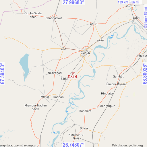
| Upper-left | 27.99683°, | 67.39403° |
| Center: | 27.37421°, | 68.09715° |
| Lower-right: | 26.74807°, | 68.80028° |
| Map W x H: | 138.8×138.9 km | = 86.2×86.3mi |
| max Lat: | 36.32162° ⇑78.6% North |
| Dokri: | 27.37421° |
| min Lat: | ⇓21.4% South 24.14422° |
| min Long | Dokri | max Long |
| 61.74573° | 68.09715° | 75.63372° |
| W 13.8%⇐ | ⇒86.2% E |
Elevation
Elevation of Dokri is 54 m = 177 ft, and this is 291 m = 955 ft below average elevation for this country.
| Max E: |
2732 m = 8963 ft | 79.7% |
| Avg. | 345 m = 1132 ft | |
| Dokri | 54 m = 177 ft | |
Min E: |
3 m = 10 ft | 20.3% |
See also: Pakistan elevation on elevation.city.
Geographical zone
Dokri is located in North temperate zone (between Tropic of Cancer and the Arctic Circle). Distance of this Northern Tropic circle is 437.8 km =272 mi to South.| Distance of | km | miles | from Dokri |
|---|---|---|---|
| North Pole | 6963.3 | 4326.8 | to North |
| Arctic Circle | 4357.4 | 2707.6 | to North |
| Tropic Cancer | 437.8 | 272 | to South |
| Equator | 3043.7 | 1891.3 | to South |


Nearby cities:
15 places around Dokri: (largest is in red/bold)
• Gambat
42 km =26.1 mi,  93°
93°
• Goth Garelo
7.1 km =4.4 mi,  342°
342°
• Goth Radhan
24.2 km =15 mi,  215°
215°
• Hingorja
36.4 km =22.6 mi,  119°
119°
• Kambar
25.6 km =15.9 mi, 338°
• Kandiaro
36.8 km =22.9 mi,  162°
162°
• Larkana
23.5 km =14.6 mi,  28°
28°
• Mehar
34.8 km =21.6 mi,  231°
231°
• Nasirabad
17.9 km =11.1 mi,  272°
272°
• Naudero
41.7 km =25.9 mi,  38°
38°
• New Bādāh
7.4 km =4.6 mi,  240°
240°
• Ranipur
41.5 km =25.8 mi,  103°
103°
• Setharja Old
40.9 km =25.4 mi, 116°
• Sobhodero
30.6 km =19 mi, 104°
• Warah
30.8 km =19.1 mi,  285°
285°
Sources, notices
• [Note1] Compared only with cities in Pakistan existing in our database
• [Src1] Map data: © OpenStreetMap contributors (CC-BY-SA)
• [Src2] Other city data from geonames.org with taken over terms of usage.
• [Src3] Geographical zone / Annual Mean Temperature by Robert A. Rohde @ Wikipedia
