Dalbandin geodata
Dalbandin (Balochistan) is a seat of a second-order administrative division; located in Pakistan in Asia/Karachi (GMT+5) time zone. With population of 14,621 people, there are 319 cities with bigger population in this country. Compared to other cities in Pakistan, 67% of cities are located further ↑North; 98.9% of cities are located further →East and 86.7% of cities have lower elevation than Dalbandin. Note1


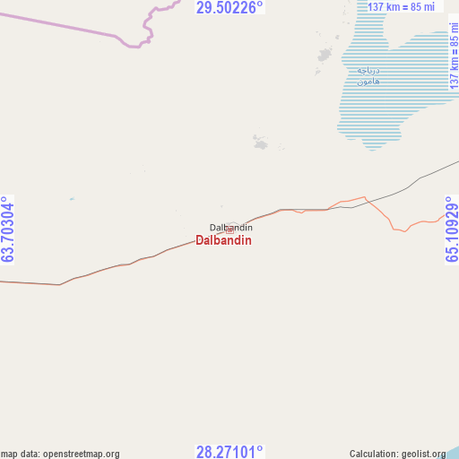
Dalbandin GPS coordinates[2]
28° 53' 18.456" North, 64° 24' 22.176" East
| Map corner | latitude | longitude |
|---|---|---|
| Upper-left | 29.50226°, | 63.70304° |
| Center: | 28.88846°, | 64.40616° |
| Lower-right: | 28.27101°, | 65.10929° |
| Map W x H: | 136.9×136.9 km | = 85.1×85.1mi |
| max Lat: | 36.32162° ⇑67% North |
| Dalbandin: | 28.88846° |
| min Lat: | ⇓33% South 24.14422° |
| min Long | Dalbandin | max Long |
| 61.74573° | 64.40616° | 75.63372° |
| W 1.1%⇐ | ⇒98.9% E |
Elevation
Elevation of Dalbandin is 851 m = 2792 ft, and this is 506 m = 1660 ft above average elevation for this country.
| Max E: |
2732 m = 8963 ft | 13.3% |
| Dalbandin | 851 m 2792 ft | |
| Avg. | 345 m = 1132 ft | |
Min E: |
3 m = 10 ft | 86.7% |
See also: Pakistan elevation on elevation.city.
Geographical zone
Dalbandin is located in North temperate zone (between Tropic of Cancer and the Arctic Circle). Distance of this Northern Tropic circle is 606.2 km =376.7 mi to South.| Distance of | km | miles | from Dalbandin |
|---|---|---|---|
| North Pole | 6795 | 4222.2 | to North |
| Arctic Circle | 4189.1 | 2603 | to North |
| Tropic Cancer | 606.2 | 376.7 | to South |
| Equator | 3212.1 | 1995.9 | to South |


Nearby cities:
15 places around Dalbandin: (largest is in red/bold)
• Awaran
282.3 km =175.4 mi,  163°
163°
• Chaman
299.7 km =186.2 mi,  41°
41°
• Gandava
301.7 km =187.5 mi,  95°
95°
• Kalat
213.4 km =132.6 mi,  85°
85°
• Kharan
104 km =64.6 mi,  108°
108°
• Khuzdar
246.7 km =153.3 mi,  119°
119°
• Kot Malik Barkhurdar
289.3 km =179.8 mi,  59°
59°
• Mach
303.3 km =188.5 mi,  69°
69°
• Mastung
257.2 km =159.8 mi, 66°
• Nushki
173.4 km =107.7 mi, 64°
• Panjgur
215.3 km =133.8 mi,  188°
188°
• Pishin
312.8 km =194.4 mi,  52°
52°
• Qila Abdullah
298.6 km =185.5 mi, 46°
• Quetta
289.4 km =179.8 mi, 60°
• Surab
186.1 km =115.6 mi, 103°
Sources, notices
• [Note1] Compared only with cities in Pakistan existing in our database
• [Src1] Map data: © OpenStreetMap contributors (CC-BY-SA)
• [Src2] Other city data from geonames.org with taken over terms of usage.
• [Src3] Geographical zone / Annual Mean Temperature by Robert A. Rohde @ Wikipedia
