Mitha Tiwana geodata
Mitha Tiwana (Punjab) is a populated place; located in Pakistan in Asia/Karachi (GMT+5) time zone. With population of 26,390 people, there are 232 cities with bigger population in this country. Compared to other cities in Pakistan, 69.5% of cities are located further ↓South; 58.5% of cities are located further ←West and 54.6% of cities have lower elevation than Mitha Tiwana. Note1


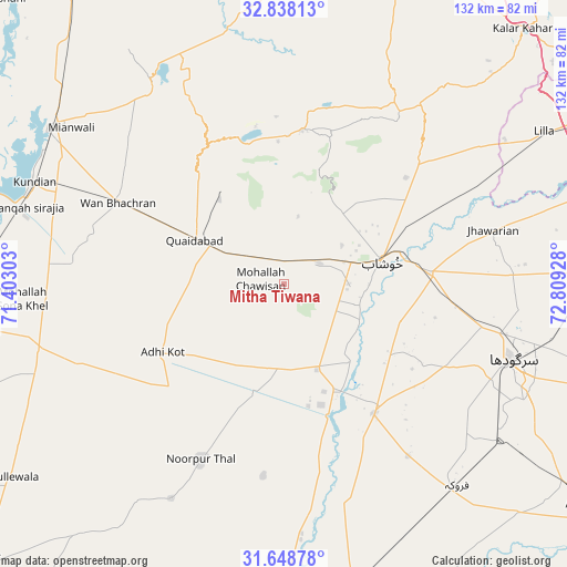
Mitha Tiwana GPS coordinates[2]
32° 14' 43.44" North, 72° 6' 22.14" East
| Map corner | latitude | longitude |
|---|---|---|
| Upper-left | 32.83813°, | 71.40303° |
| Center: | 32.2454°, | 72.10615° |
| Lower-right: | 31.64878°, | 72.80928° |
| Map W x H: | 132.2×132.2 km | = 82.1×82.1mi |
| max Lat: | 36.32162° ⇑30.5% North |
| Mitha Tiwana: | 32.2454° |
| min Lat: | ⇓69.5% South 24.14422° |
| min Long | Mitha Tiwana | max Long |
| 61.74573° | 72.10615° | 75.63372° |
| W 58.5%⇐ | ⇒41.5% E |
Elevation
Elevation of Mitha Tiwana is 190 m = 623 ft, and this is 155 m = 509 ft below average elevation for this country.
| Max E: |
2732 m = 8963 ft | 45.4% |
| Avg. | 345 m = 1132 ft | |
| Mitha Tiwana | 190 m = 623 ft | |
Min E: |
3 m = 10 ft | 54.6% |
See also: Pakistan elevation on elevation.city.
Geographical zone
Mitha Tiwana is located in North temperate zone (between Tropic of Cancer and the Arctic Circle). Distance of this Northern Tropic circle is 979.4 km =608.6 mi to South.| Distance of | km | miles | from Mitha Tiwana |
|---|---|---|---|
| North Pole | 6421.7 | 3990.3 | to North |
| Arctic Circle | 3815.8 | 2371 | to North |
| Tropic Cancer | 979.4 | 608.6 | to South |
| Equator | 3585.4 | 2227.9 | to South |


Nearby cities:
15 places around Mitha Tiwana: (largest is in red/bold)
• Bhalwal
74.5 km =46.3 mi,  88°
88°
• Faruka
49.3 km =30.6 mi,  144°
144°
• Harnoli
52 km =32.3 mi,  274°
274°
• Jahanian Shah
51.5 km =32 mi,  161°
161°
• Jauharabad
17.2 km =10.7 mi,  73°
73°
• Jhawarian
50.2 km =31.2 mi,  75°
75°
• Keshupur
37.1 km =23.1 mi, 87°
• Khushāb
23.9 km =14.9 mi, 76°
• Kundian
63.5 km =39.5 mi,  291°
291°
• Mangla
47 km =29.2 mi,  146°
146°
• Mianwali
65.6 km =40.8 mi,  304°
304°
• Sahiwal
36.9 km =22.9 mi, 144°
• Sargodha
56.3 km =35 mi,  108°
108°
• Shahpur
34.2 km =21.3 mi, 85°
• Sillanwali
62.1 km =38.6 mi, 138°
Sources, notices
• [Note1] Compared only with cities in Pakistan existing in our database
• [Src1] Map data: © OpenStreetMap contributors (CC-BY-SA)
• [Src2] Other city data from geonames.org with taken over terms of usage.
• [Src3] Geographical zone / Annual Mean Temperature by Robert A. Rohde @ Wikipedia
