Jahanian Shah geodata
Jahanian Shah (Punjab) is a populated place; located in Pakistan in Asia/Karachi (GMT+5) time zone. With population of 29,095 people, there are 215 cities with bigger population in this country. Compared to other cities in Pakistan, 62.3% of cities are located further ↓South; 60.3% of cities are located further ←West and 53% of cities have higher elevation than Jahanian Shah. Note1


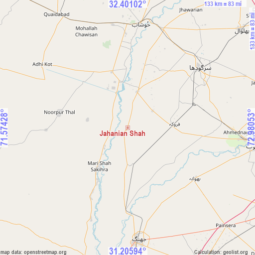
Jahanian Shah GPS coordinates[2]
31° 48' 19.476" North, 72° 16' 38.64" East
| Map corner | latitude | longitude |
|---|---|---|
| Upper-left | 32.40102°, | 71.57428° |
| Center: | 31.80541°, | 72.2774° |
| Lower-right: | 31.20594°, | 72.98053° |
| Map W x H: | 132.9×132.9 km | = 82.6×82.6mi |
| max Lat: | 36.32162° ⇑37.7% North |
| Jahanian Shah: | 31.80541° |
| min Lat: | ⇓62.3% South 24.14422° |
| min Long | Jahanian Shah | max Long |
| 61.74573° | 72.2774° | 75.63372° |
| W 60.3%⇐ | ⇒39.7% E |
Elevation
Elevation of Jahanian Shah is 171 m = 561 ft, and this is 174 m = 571 ft below average elevation for this country.
| Max E: |
2732 m = 8963 ft | 53% |
| Avg. | 345 m = 1132 ft | |
| Jahanian Shah | 171 m = 561 ft | |
Min E: |
3 m = 10 ft | 47% |
See also: Pakistan elevation on elevation.city.
Geographical zone
Jahanian Shah is located in North temperate zone (between Tropic of Cancer and the Arctic Circle). Distance of this Northern Tropic circle is 930.5 km =578.2 mi to South.| Distance of | km | miles | from Jahanian Shah |
|---|---|---|---|
| North Pole | 6470.6 | 4020.6 | to North |
| Arctic Circle | 3864.7 | 2401.4 | to North |
| Tropic Cancer | 930.5 | 578.2 | to South |
| Equator | 3536.4 | 2197.4 | to South |


Nearby cities:
15 places around Jahanian Shah: (largest is in red/bold)
• Bhawana
43.9 km =27.3 mi,  126°
126°
• Chenab Nagar
60.4 km =37.5 mi,  95°
95°
• Faruka
15.7 km =9.8 mi,  55°
55°
• Jauharabad
53.9 km =33.5 mi,  0°
0°
• Jhang City
55.8 km =34.7 mi,  175°
175°
• Jhang Sadr
59.7 km =37.1 mi, 176°
• Keshupur
54.7 km =34 mi,  22°
22°
• Khushāb
55.1 km =34.2 mi,  7°
7°
• Lalian
49.5 km =30.8 mi,  87°
87°
• Mangla
13.9 km =8.6 mi,  45°
45°
• Mitha Tiwana
51.5 km =32 mi,  341°
341°
• Sahiwal
19.4 km =12.1 mi, 15°
• Sargodha
48.7 km =30.3 mi, 50°
• Shahpur
54.5 km =33.9 mi, 19°
• Sillanwali
25 km =15.5 mi,  84°
84°
Sources, notices
• [Note1] Compared only with cities in Pakistan existing in our database
• [Src1] Map data: © OpenStreetMap contributors (CC-BY-SA)
• [Src2] Other city data from geonames.org with taken over terms of usage.
• [Src3] Geographical zone / Annual Mean Temperature by Robert A. Rohde @ Wikipedia
