Fort Abbas geodata
Fort Abbas (Punjab) is a populated place; located in Pakistan in Asia/Karachi (GMT+5) time zone. With population of 40,626 people, there are 153 cities with bigger population in this country. Compared to other cities in Pakistan, 65.5% of cities are located further ↑North; 69.5% of cities are located further ←West and 59.4% of cities have higher elevation than Fort Abbas. Note1


Fort Abbas GPS coordinates[2]
29° 11' 36.384" North, 72° 51' 18.9" East
| Map corner | latitude | longitude |
|---|---|---|
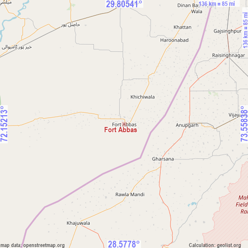
| Upper-left | 29.80541°, | 72.15213° |
| Center: | 29.19344°, | 72.85525° |
| Lower-right: | 28.5778°, | 73.55838° |
| Map W x H: | 136.5×136.5 km | = 84.8×84.8mi |
| max Lat: | 36.32162° ⇑65.5% North |
| Fort Abbas: | 29.19344° |
| min Lat: | ⇓34.5% South 24.14422° |
| min Long | Fort Abbas | max Long |
| 61.74573° | 72.85525° | 75.63372° |
| W 69.5%⇐ | ⇒30.5% E |
Elevation
Elevation of Fort Abbas is 147 m = 482 ft, and this is 198 m = 650 ft below average elevation for this country.
| Max E: |
2732 m = 8963 ft | 59.4% |
| Avg. | 345 m = 1132 ft | |
| Fort Abbas | 147 m = 482 ft | |
Min E: |
3 m = 10 ft | 40.6% |
See also: Fort Abbas elevation on elevation.city.
Geographical zone
Fort Abbas is located in North temperate zone (between Tropic of Cancer and the Arctic Circle). Distance of this Northern Tropic circle is 640.1 km =397.7 mi to South.| Distance of | km | miles | from Fort Abbas |
|---|---|---|---|
| North Pole | 6761.1 | 4201.2 | to North |
| Arctic Circle | 4155.2 | 2581.9 | to North |
| Tropic Cancer | 640.1 | 397.7 | to South |
| Equator | 3246 | 2017 | to South |


Nearby cities:
15 places around Fort Abbas: (largest is in red/bold)
• Bahawalnagar
97.4 km =60.5 mi,  23°
23°
• Bahawalpur
116.7 km =72.5 mi,  281°
281°
• Būrewāla
110 km =68.4 mi,  349°
349°
• Chishtian
67.1 km =41.7 mi,  0°
0°
• Dhanot
115.2 km =71.6 mi,  291°
291°
• Dinan Bashnoian Wala
75 km =46.6 mi,  31°
31°
• Dunga Bunga
72.4 km =45 mi, 31°
• Faqirwali
35.1 km =21.8 mi, 29°
• Harunabad
54 km =33.6 mi, 30°
• Hasilpur
63 km =39.1 mi,  331°
331°
• Kahror Pakka
103 km =64 mi,  297°
297°
• Khairpur Tamewah
73.7 km =45.8 mi,  305°
305°
• Mailsi
94.4 km =58.7 mi,  315°
315°
• Vihari
106.2 km =66 mi, 332°
• Yazman
108.1 km =67.2 mi,  265°
265°
Sources, notices
• [Note1] Compared only with cities in Pakistan existing in our database
• [Src1] Map data: © OpenStreetMap contributors (CC-BY-SA)
• [Src2] Other city data from geonames.org with taken over terms of usage.
• [Src3] Geographical zone / Annual Mean Temperature by Robert A. Rohde @ Wikipedia
