Dinan Bashnoian Wala geodata
Dinan Bashnoian Wala (Punjab) is a populated place; located in Pakistan in Asia/Karachi (GMT+5) time zone. With population of 7,500 people, there are 374 cities with bigger population in this country. Compared to other cities in Pakistan, 61.2% of cities are located further ↑North; 78.1% of cities are located further ←West and 55.3% of cities have higher elevation than Dinan Bashnoian Wala. Note1


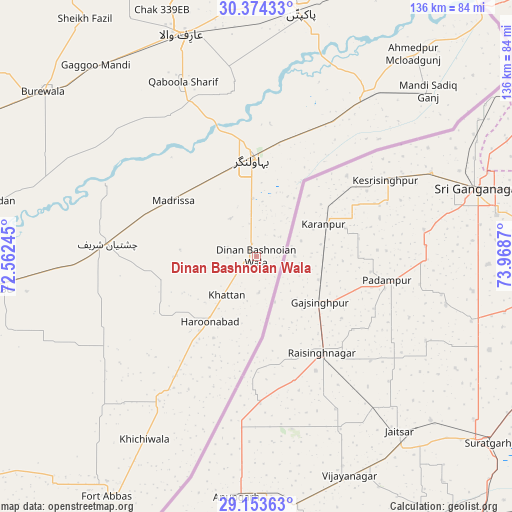
Dinan Bashnoian Wala GPS coordinates[2]
29° 45' 57.024" North, 73° 15' 56.052" East
| Map corner | latitude | longitude |
|---|---|---|
| Upper-left | 30.37433°, | 72.56245° |
| Center: | 29.76584°, | 73.26557° |
| Lower-right: | 29.15363°, | 73.9687° |
| Map W x H: | 135.7×135.7 km | = 84.3×84.3mi |
| max Lat: | 36.32162° ⇑61.2% North |
| Dinan Bashnoian Wala: | 29.76584° |
| min Lat: | ⇓38.8% South 24.14422° |
| min Long | Dinan Bashnoian | max Long |
| 61.74573° | 73.26557° | 75.63372° |
| W 78.1%⇐ | ⇒21.9% E |
Elevation
Elevation of Dinan Bashnoian Wala is 162 m = 531 ft, and this is 183 m = 600 ft below average elevation for this country.
| Max E: |
2732 m = 8963 ft | 55.3% |
| Avg. | 345 m = 1132 ft | |
| Dinan Bashnoian Wala | 162 m = 531 ft | |
Min E: |
3 m = 10 ft | 44.7% |
See also: Pakistan elevation on elevation.city.
Geographical zone
Dinan Bashnoian Wala is located in North temperate zone (between Tropic of Cancer and the Arctic Circle). Distance of this Northern Tropic circle is 703.7 km =437.3 mi to South.| Distance of | km | miles | from Dinan Bashnoian Wala |
|---|---|---|---|
| North Pole | 6697.4 | 4161.6 | to North |
| Arctic Circle | 4091.5 | 2542.3 | to North |
| Tropic Cancer | 703.7 | 437.3 | to South |
| Equator | 3309.7 | 2056.6 | to South |


Nearby cities:
15 places around Dinan Bashnoian Wala: (largest is in red/bold)
• Arifwala
61.4 km =38.2 mi,  341°
341°
• Bahawalnagar
25.9 km =16.1 mi,  357°
357°
• Bahawalnagar
88.1 km =54.7 mi,  7°
7°
• Būrewāla
74.2 km =46.1 mi,  306°
306°
• Chak One Hundred Twenty Nine Left
76.7 km =47.7 mi, 343°
• Chak Thirty-one -Eleven Left
91.3 km =56.7 mi,  323°
323°
• Chishtian
39.5 km =24.5 mi,  275°
275°
• Dunga Bunga
2.8 km =1.7 mi,  230°
230°
• Faqirwali
39.9 km =24.8 mi,  213°
213°
• Fort Abbas
75 km =46.6 mi, 211°
• Harunabad
21.1 km =13.1 mi,  215°
215°
• Hasilpur
70 km =43.5 mi,  263°
263°
• Haveli Lakha
86.6 km =53.8 mi,  28°
28°
• Minchianabad
53 km =32.9 mi, 33°
• Pakpattan
65.3 km =40.6 mi, 10°
Sources, notices
• [Note1] Compared only with cities in Pakistan existing in our database
• [Src1] Map data: © OpenStreetMap contributors (CC-BY-SA)
• [Src2] Other city data from geonames.org with taken over terms of usage.
• [Src3] Geographical zone / Annual Mean Temperature by Robert A. Rohde @ Wikipedia
